We went up north and had dinner with A and A. The menu included coq au vin, potatoes pavé, mushroom soup with home made croutons, roasted carrots, and a rather extraordinary salad. Everything was awesome, including the blackberry pie for dessert.
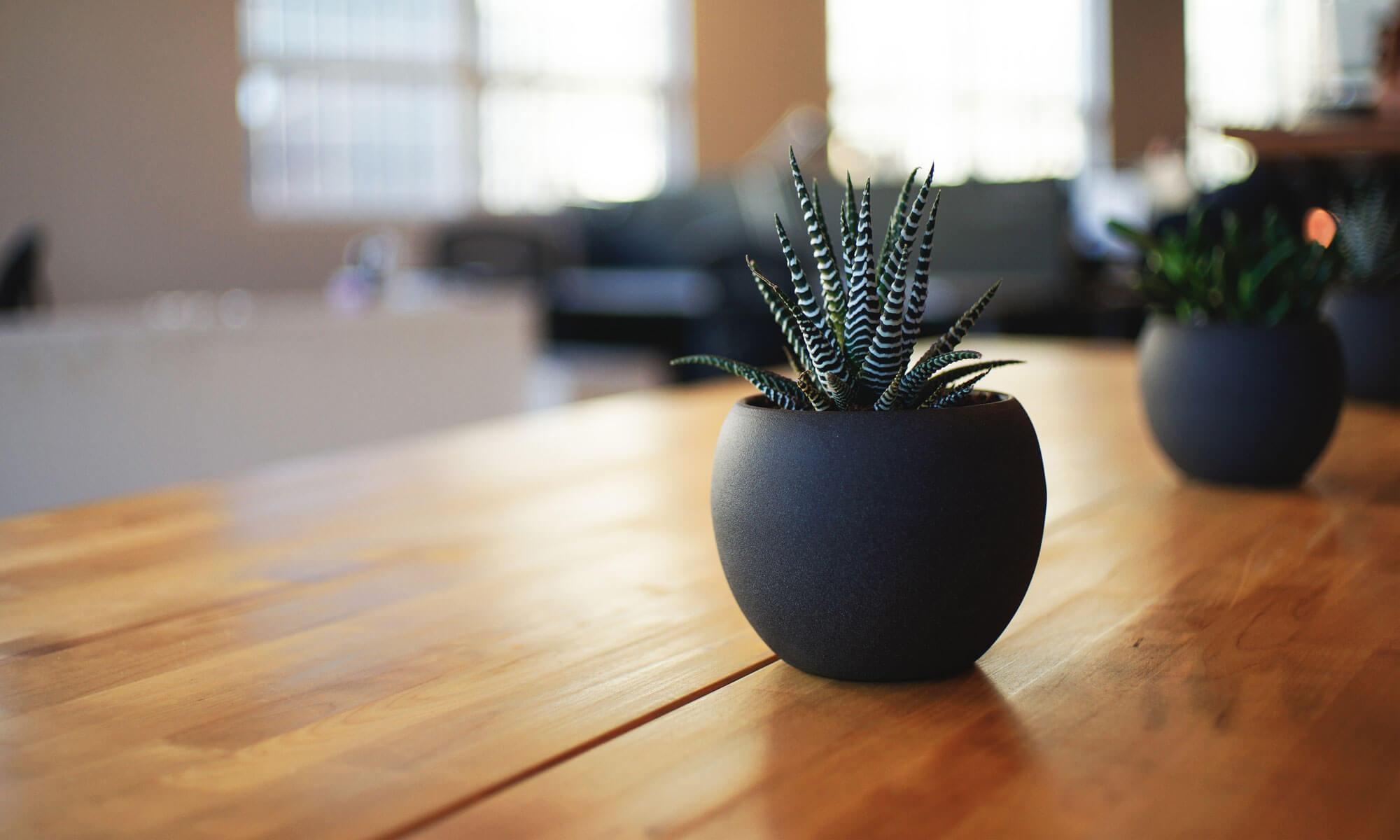
The chopped kale and endive salad was topped with haloumi slices and–at the very top–with culinary crystals, a.k.a. chef’s pop rocks.
A’s great grandmother’s china also made an appearance.
As part of the festivities, we were required to pay homage to the restaurant manager, who, by chance, happened to be a hamster. Since hamsters are nocturnal, she was just waking up as we were finishing dinner. After some coaxing, she accepted a blueberry from E and then obliged us by taking a brief turn on the wheel and by having two good rolls in her sandbox bathing area. Excellent.
At the end of the evening, we went off to stay the night at a Best Western.
Thursday, December 25th
Before going back to A and A’s for present opening, we stopped at the motel breakfast room. There we saw three other couples about our age. It was hard not to think that maybe they were traveling for the same purpose and on the same schedule as we were. Back at the Andees’ we had a leisurely present opening ceremony. Besides our treeside presents, we got a bonus in the form of efficiently packed leftovers from the previous night’s meal.
We had a nice drive back from Portland. The rain held off and the I-5 traffic was light, with noticeably fewer semi trucks than normal.
Friday, December 26th
We made an evening meal of Christmas Eve leftovers today. If anyone wonders whether potatoes pavé can still be good after two days in the fridge, the answer is oh yes. And did we mention the pancetta, the mushrooms, the pearl onions all that other stuff in the coq au vin? They were all right too.
Sunday, December 28th
We went down to Herbert Farm and Natural Area today to see how lazy old Muddy Creek was doing. The trail was flooded in its usual place just thirty yards from the trailhead, but our detour through the field was fine–squishy but passable. Further along, down by the old road crossing, the creek was making some noise.
The water is falling over some kind of weir that was built back in the day in order to make a seasonal ford.
Here’s the ford. The Herbert family once depended on this road to get them over to the west side of their property. Muddy Creek would have been fordable here for much of the year, though maybe not at times like these. The additional barrier of a fallen tree is a recent addition that we hadn’t seen before. You can see the white water of the falls on the right side the photo..
One of the nicest things about this area is the chance to see lots of Oregon white oaks. There’s one sizable grove out in the middle of the fields. You can see it in the background above. But there are many more growing along the east side of the creek, including several giants. White oaks generally live for 200 to 300 years and have been known to live 500 years. So this recently fallen one is likely to have sprouted long before the European farmers arrived.
To restore the riparian habitat, thousands of native seeds and seedlings were planted along the creek in the late 2010’s. By now they are well established. Current restoration efforts are focused on the control of non-native plant species, including North Africa grass, Velvet grass, Reed Canary grass, Oneseed hawthorn, Common sheep sorrel, and Stinking chamomile. (Yeah! We don’t need no stinking chamomile!) Of the six, North Africa grass is considered to be the worst threat, as it can outcompete both native grasses and native flowering plants, resulting in decreased biodiversity. The fight against the non-natives will have to be an ongoing effort because some of them have been growing in the area for quite a while, creating long lasting seed banks in the soil. And as for Oneseed hawthorn…well, there’s a big stand of that on an adjacent property. That’ll keep them busy.
Stinking chamomile (Anthemis cotula) closely resembles true chamomile (Anthemis nobilis.) One way to tell the difference is to look for membraneous scales underneath the flowers: A. nobilis has them and A. cotula doesn’t. Another way to tell is that A. cotula smells terrible.
Tuesday, December 30th
A nice sunny day here, colder but beautiful. Last night we had our first real frost of the season. Hard to believe it took this long.
Wednesday, December 31st
Another sunny day. A good day to get outside and go snowshoeing mow the lawn. Sounds ridiculous to be mowing the grass on New Year’s Eve, but weather is weather and grass is grass. M wasn’t the only one in the neighborhood out taking advantage of the day.
Champagne and a new jigsaw puzzle kept us awake long enough to see in the new year.
Thursday , January 1st
New Year’s dinner with B, J and P at B and J’s place. More delicious food. Scalloped apples! Christmas cake! Lemon tarts! Emergency samosas from the Mother of Markets (as Roland used to say.)
Afterward, we worked more on the puzzle, which is a view of Neuschvanstein Castle. It’s beautiful, but pretty hard. Might take the rest of the year…
It was an unexpectedly lovely day today: a few little showers but then partly sunny. We went walking in one of the nicest–and strangest–places in our local forest. The trail starts from Soap Creek Road and takes a tour around the lower portion of Baker Creek. We’ll call it the Baker Creek Loop. Part of the route is in the OSU forest, but a portion of it leads into privately owned land. It’s not an official trail and is not well maintained. It is popular, though, and has always quite been passable, just a bit more challenging than the typical trails. We had been on it many times, but not in recent years.
At first the trail was just as we remembered. We followed it up a much overgrown logging road until we reached the site of a forty-year-old old landslide that had obliterated a big section of the road. From there, we took the detour that other hikers had created long ago. This is a rough, improvised trail that climbs steeply up the mountainside, traverses the width of the slide and then quickly drops back down to the roadbed. We were expecting this and it wasn’t all that hard. About a quarter mile farther on, however, we came to a completely new obstacle. We came to a place where a small stream had always flowed across the trail before flowing into Baker Creek. It had been a little messy sometimes, but never a problem. You just walked across on the driest part you could find. But now, a huge V-shaped trench had been dug across the roadbed. The little stream flowed at the bottom, five feet below the level of the trail. This gave us pause. To get across, we would have to scramble down one muddy bank, step lightly across the stream, and then scramble up the far bank. It wasn’t really what we had set out to do that day, but we guessed we’d have to try. It was fine.
But then, soon after that crossing, we came to another big gash in the road where another stream crossed the trail. This trench was even deeper and the sides were so steep that scrambling down was out of the question. We had to detour off the trail down a steep slope through the brush, find a safe place to step across the stream, and then scramble back up to the level of the trail again. Geez. After that we still had to cross Baker Creek itself. Here’s what that crossing looked like:
The two trenches had been surprises. At least this crossing was one that we remembered..
After we got across the main creek, things were pretty easy. Eventually we came to a real logging road that we knew would loop down to the place where we had started. Good. We had had enough adventuring.
Here’s a scene from our climb up out of the Baker Creek ravine and up to the road that would complete the loop..
Monday, December 1st
A has given us a very interesting advent calendar, one that includes a little fifty piece jigsaw puzzle for each of the twenty-four days. We did the first one today:
Tuesday, December 9th
E and A left today for Bozeman, Montana, where they will attend a memorial service for a longtime friend.
M remains at home to fetch the packages in from the front porch and to monitor an unusual event: the replacement of an eighty year old power pole and transformer located deep in our neighbors’ back yard. The electricity will be off for a few hours tomorrow, during which time M plans to power his computer via an extension cord plugged into the EV6.
Wednesday, December 10th
Thursday, December 11th
E returned today from Montana. As she was leaving Bozeman, she noticed this sign at the Alaska Airlines counter:
We totally agree with this rule. We would never try to put a bear into any kind of luggage. If you want to take a bear with you, for heaven’s sake buy it a seat.
The funeral that E attended was for her friend Phil, who died recently at the age of 97. For much of his working life, Phil worked in ski patrol, first at Mt. Batchelor here in Oregon and later–when Bend got too crowded for his taste–at Big Sky Resort in Montana. A specialist in emergency medicine, Phil remained in the Big Sky patrol until he was nearly 90 years old. Mountain Outlaw Magazine made a short video feature about Phil in 2017. At that time he was thought to be the oldest active ski patroller in the country.
On Wednesday morning the Big Sky Ski Patrol organized a memorial for Phil, his final trip down the hill. His patroller friends and other mourners went to the top of the mountain and skied down together, spreading his ashes as they went. At the evening service several people told stories, including one about the time Phil was driving home off a mountain in his Subaru and struck a bad patch of ice. His long slide ended with the Subaru turned over on its side, passenger side down, with Phil still belted into his seat on the driver’s side, which was now quite high in the air. Three of his fellow patrollers came along soon after and figured that the old timer needed some help. They went over to the car and started talking about how they were going to get him out of the car. Phil rolled down his window and said that he didn’t need to get out. He was just waiting for someone to turn the car back onto its wheels so he could get home. When they’d done that, Phil rolled up the window and drove away.
Friday, December 12th
We have to say that the last months have been a somber time for us. We are both fine–as well as can be expected–but cold winds swirl around us. Since May we have lost three friends, all of whom were points of light for us. And now two more people that we care about appear to be on the threshold. Not a happy time.
From our living room window we can see hundreds of blossoms on the Mexican orange plant. It may be trying to tell us something. We’re not sure we’re in the mood to listen.
Of course it is still Christmastime. Besides traveling to funerals and watching poles get changed, we’ve got a little tree up and running and managed to complete most of our shopping. Plus, we’ve done exactly half of our advent jigsaw.
Today we went out for a “Woodpecker Walk” organized by the Greenbelt Land Trust at Bald Hill Farm. Many years ago Greenbelt started working to turn a portion of its core property into a flourishing oak savannah, a kind of habitat that supports hundreds of species, both vertebrate and invertebrate. The most visible of these are acorn woodpeckers, which are now plentiful on the Farm. At the start of the walk, we were told that Lewis woodpeckers have also been seen this year. The Lewis variety is less common and in some years none are seen at all. Our guides were hoping that our group would be able to catch sight of both species.
Yes, E and M were really there. And we have this non-AI created photo to prove it.And we did see a few Lewis woodpeckers, but not nearly so clearly as in this. The photo shown here was taken on a different occasion by a photographer with a longer lens than ours and more patience that we’ll ever have.
We also saw lots of acorn woodpeckers and learned about their granaries. The birds make their granaries on dead limbs and snags, pecking acorn sized holes in the wood and then pushing a single acorn into each cavity for storage.
This was just one of the many granaries that we saw. M reports that the granaries are much easier to spot than the birds.
Bald Hill Farm is also home to sapsuckers, who are another sort of woodpecker. Here’s an image that shows how generations of sapsuckers have fed from the trunk of this very old pear tree. The dark horizontal lines are actually rows of closely spaced feeding holes.
Tuesday, Nov. 11th
We went over to the coast today and walked through Mike Miller Park just south of Newport. The forecast had called for clouds, but it turned out to be mostly sunny. It’s high season for mushrooms over there, and we met several gatherers, including a jolly elf woman carrying a basket that she had filled with an assortment of both mushrooms and lichens. She was not hunting edibles but instead was collecting for the purpose of making natural dyes. (See, for example, these mushroom dyed yarns from Sweden.)
We were just collecting a few photos.
This spot is about half a mile from the ocean. The trees are so old and the soil so rich that it’s hard to believe that this was once a sand dune. But the stream bed here provides an obvious clue. Naturally, E had to climb down and get her hands into the water. She says that the sand was as smooth as maple sugar cream.
Later we drove along Nye Beach and stopped to have a look down at the ocean from Davis Park . The wind was brisk from out of the south, as you can see in the clip below.
For dinner we went to Local Ocean. As usual, we had a fine meal. We found, though, that their prices have gone up some. We stayed away from the high end entrees. Instead, E had a $25 dollar salad and M a $25 sandwich, both of which were delicious. We drank beer, which was $7 a glass but also good. The wines on offer were all in the range of $15-21 a glass. With tip added, that’s $18-25, which seems excessive for a glass of wine–even in today’s world.
Wednesday, Nov. 12th
On our way back to Corvallis we stopped at Moonshine Park, a fairly remote Lincoln County park and campground. To get there we drove 8 miles east from Siletz to Logsden, then 5 or 6 miles north from there. The sign that shows the turn-off to the park is easy to spot , which is good because if you just keep going straight, the next civilization you will see will be either Kings Valley or Falls City, and that’s assuming that you ever manage to find your way out of the forest at all. (Ha-ha, just kidding.)
The main attraction of Moonshine Park is that it is situated at a place where the Siletz River widens into a lake-like pool with a gently flowing current, making it a great place for summertime swimming. The waterfall is a lovely bonus.
There are also mushrooms…
…and huge riverside trees with complicated roots..
Saturday, Nov. 15th
Rumor has it that E has entered into negotiations to buy a bicycle. Our crack investigative team is even now attempting to get more details. (It might take a while, though, as our team members have slowed down a little over the years.)
We had dinner this evening at Corazon. Sigh. They have lost their charm for us. Our meals were “interesting” which is code for “different but not very good.” Do they have a new chef? But at least we could have some wine. That was very good and they charged us roughly half the price of that other place.
Our Monday was busy again. It began with both of us going off to our respective grocery stores and then spending some time on our respective exercise routines–a walk in the forest for E and some sod chopping for M. We got back together for lunch, after which we drove off to see the new Starbucks. Doesn’t that sound exciting!
Our town’s two oldest Starbucks both recently shut down, causing one long-time customer to write a grouchy letter to the newspaper. The new Starbucks occupies the site of an old Taco Time where we used to go for lunch. Did they retain the arched doorway and the cactus? Uh…no. Also: Was it nice inside? Sure, it’s all in shades of brown, but it’s prettier than the old Taco Time. Was the coffee good? E was very pleased with her mocha. We saw that they had bagels. We wanted to ask if they served them with cups half full of melted butter for dunking, but we didn’t.
Later In the afternoon E went to the dentist, thus raising the day’s most critical question: Would she get a mini-cupcake, something that her dentist sometimes has on hand for the benefit of discerning clients? Well….as it happened, she did get a cupcake. She brought it home and tried to eat it after dinner. Aaagh! It was matcha flavored! Her face fell! She was not pleased. We long for simpler times.
Wednesday, October 22nd
Besides his visits to the Maury Mountains and the Cascades–where E led him on a hike that nearly killed him–M has also gone wandering through the Coast Range. Such a picturesque area, especially if you get off the main roads! Here’s a sample:
So…a lot of harvesting going on here. But what about those trees in the middle? Is there something wrong with them? We’re pretty sure that this cutting pattern results from state forestry regulations that prohibit cutting trees within a certain distance of a stream. The system of rules is wonderfully complicated. You can get a sense of that complexity here. Seasonal streams like the ones in the photo have fairly narrow exclusion zones, which leads to strange looking bands like this.
Friday, October 24th
After a week of pretty good weather, today the rain is falling.
Saturday, October 25th
Went for a walk in the neighborhood today, despite a brisk downpour. While we were on the return half of our loop, the rain paused and we got our reward, a spectacular rainbow. One end seemed to anchored somewhere near our house, the other on the hillside from which we were returning. Alas, it disappeared pretty quickly.
Dinner at the Dizzy Hen in Philomath. With E at the wheel of Mavi (as the EV6 has been christened) we arrived at 5:26, just in time to get a good place in line for the 5:30 opening.
Sunday, October 26th
After two days of rain and a few sudden blasts of strong wind, it definitely looks like fall here. It’s a good thing M’s two projects are more or less done.
Just left of center is what used to be a wide grass walkway.
And here’s what used to be a bark chip walkway.
E and H went back to PRAX theatre today to hear the Corvallis Repertory Singers perform J.S. Bach’s “Wachet auf” (in English: Wake up) followed by Mozart’s “Great Mass in C minor.” The program notes suggest that by listening to these two works back to back, listeners will be able to hear how Bach’s work influenced Mozart’s. While E was at PRAX, M spent two hours at home listening to Nina Simone, a singer he’d long wanted to know better. He was impressed enough by the music to want to know a little more about her life. He found that she was an American singer and pianist who first found success in the 1950’s with songs that combined folk, blues, and jazz influences. Before this time, she had been struggling to make a career as a classical concert pianist. At age 17, she spent one summer studying with German pianist Carl Friedberg at the Julliard School. In order to fund more classical training, she took various jobs, including gigs playing piano at clubs and restaurants. Her singing career did not begin until a bar owner offered her extra money if she would sing while she played. Critics have always claimed to be able to see classical influences in Simone’s popular work and some have pointed out that her piano playing seems especially similar to the music of….wait for it….J.S. Bach. Well, says M, Nina Simone ain’t no Mozart, but Mozart ain’t no Nina Simone either.
Monday, October 27th
Hiked at Mary’s Peak today. It was a cold and damp, but not actually raining very much.
It’s mushroom season.
Also logging season.
Nice views from the top though.
Thursday, October 30th
We spent much of the morning undoing the damage from M’s online attempt to buy a couple of spare dinner plates. He found exactly what he wanted on what appeared to be housewares website. The price was very attractive! Alas, once he had entered his info and pressed the order button, nothing happened–no order confirmation, no nothing. Becoming suspicious, he googled the name of the website and found out that it was flagged as fraudulent. Oops. Had to cancel the card and get a new one. That turns out to be pretty easy these days.
Friday, October 31st
To the delight of most of our trick or treaters, our front yard has a new form of wildlife.
E took off in the blue car today, heading south to Springfield and then east up the McKenzie River Valley. Her friends H and N had invited her to spend a night or two with them in an AirBnB on the banks of the river. Being a sensible person, E drove directly to her destination, guided by GPS as well as by a printout of the route directions given by the AirBnB host. It turned out to be a wonderful spot.
That’s the McKenzie River there beyond the railing. The river is still running strong, even at this dry time of year.
Meanwhile, M went off in the truck on his own expedition. His destination was Prineville, which is more or less directly east of Corvallis. And indeed M began his trip sensibly by driving directly east on Highway 34. But of course this is the same M who is still doing research for his next magnum opus: How To Find the Slowest Way to Get Almost Anywhere, so you will not be surprised to hear that he turned off this route just before reaching Lebanon, taking first Steckley Road, then Highway 223 and then wandering southeast on Calapooia River Drive.
As some of you may be aware, this innocent sounding road soon turns to gravel and goes on and on and on, finally reaching a Y intersection in a deep dark forest at a spot whose GPS coordinates reveal only that it is a long way from anywhere. M advises that if you ever reach this Y junction, you should bear left. Should you bear right, it is quite possible that you will climb very high up and then come to a dead end. There you will be forced to turn your vehicle around at a place where no sensible person would ever want to do such a thing. Assuming you survive this experience, you can return to the Y and try the left arm. If you do, and if your luck holds , you will end up on Canyon Creek Road, which will lead you down finally to pavement on good old Highway 20. It’s true that this last stretch will lead you westward, away from the stated destination of Prineville, but it will all work out.
Wednesday, October 8th
Today E and her friends drove a bit farther up Highway 126 and visited…
Koosah Falls
M, meanwhile, spent the day driving around some small mountains called the Maury Range. He renewed his acquaintance with Forest Service Road 16, got some nice views from FSR 150, and achieved his long-held goal of driving the length of FSR 1750. By Forest Service convention, the number of digits in the road number gives a clue to what sort of road it might be. Roads with two digit numbers tend to be wide with smooth, well maintained gravel. Roads with three digit numbers are narrower. They are usually smooth, but are less frequently maintained, which can lead to rough spots. Four-digit roads, like FSR 1750 in the Maurys, are the roughest–and of course slowest.
Road 150 provides some nice views to the north. You can see that the road is narrow but smooth and only gently sloping. If you want to drive off the cliff you can, but you have to find a place where there aren’t any trees.
Week of October 9thto 16th
We’ve had several bouts of rain this month, but also many days of sun. The parched lawns in the neighborhood are turning back to green, while the leaves on the trees are less green with every passing day. Although the freezer is already well stocked with E’s applesauce, there are still plenty of bright red apples on the tree. M has finished most of his grass removal/soil rehab project and is now hunting up things to plant in the new space.
Wednesday, October 15th
Today we took a break from our recent routine and went for a hike on Browder Ridge up around Tombstone Pass in the Cascades. We took the Gate Creek Trail. We’d been there once or twice before, but it had been a long time. It’s just 1.6 miles from the trailhead to the viewpoint, but there is some elevation gain involved–1,150 feet. So it was definitely a challenge.
The weather was fine: cold in the shade, much warmer in the sun. The first part of the trail was all shade, switchbacking steeply up through a mature forest that featured some nice swaths of rhododendron understory. As we climbed higher, we began to see older and older trees. After about half a mile the trail leveled out, running gently upward with no switchbacking needed. In this section we saw dozens of really big firs. Clearly this part of the forest has never been logged, at least not in the last three or four hundred years. This phase lasted for another half mile, at which point the trail turned right and started switchbacking again. Here the trees weren’t as big, and we saw a greater variety of species. As we climbed, we occasionally came upon patches of steep bracken meadows, places where no trees were growing. We wondered why not. Mostly, though, the last half mile of switchbacks took us through thick forest with not a view in sight. Then, quite suddenly, we came out of the trees to find ourselves at the top of a very large meadow. And there we found the views.
In the lowest part of the trail we saw lots of trillium. They are long past blooming and we were a little surprised to see them still standing this late in the year. Like the rhododendron, they made us want to come back in the spring.
Compared to tree farms, natural forests are really messy.Sometimes, when trees fall, they don’t even make it to the ground.
There was a little snow here and there, just enough to be interesting.
Here’s our first glimpse of the view from the top of the meadow. The two peaks are the North and Middle Sisters.
Besides fir, we saw quite of bit of western red cedar, bright green and shaggy looking. And isn’t that a spruce there in the middle?
It was quite a scene, what with the snow on the peaks and all. The photo above shows Mt. Jefferson (behind a tree) and Three Fingered Jack on the right. But also visible from the same spot were Mt. Washington, South Sister, and a number of smaller volcanic cones and craters. After oohing an aahing a bit, we located some almost comfortable rocks out in the sunshine and sat down for lunch.
Lunch ended up having two phases. First we had our sandwiches, veggies and chips. Just as we were finishing those, our sunny spot turned to shade and became noticeably colder. To properly enjoy dessert we had to relocate ourselves to a less than stable log. Life is tough out in the wilderness! Somehow we managed it and before long we were headed back down.
On the way down we noticed a big old fir, long dead and broken off about 15 feet above the ground. Someone–insects presumably–have been hard at work on what remains. It reminded us of the towers of the Sagrada Familia.
Friday, October 17th
E went out and about downtown today. In the midst of her errands, she dropped in at Futura for a latte. She also asked for a bagel. The barista informed her that the shop had run out of cream cheese and that the only topping they had was butter. Okay, said E, expecting to get by with just a pat or two. But that’s not what she got.
She got…dunking butter. She says it was pretty good.
While this was going on, M was out riding around the hills in the little red car. It was fun, but he didn’t see any butter anywhere.
Sunday, October 19th
On the literary front, E is reading three different books at once, one of them being The Book Woman of Troublesome Creek. E also found something for M to read: Parul Sehgal’s NYT review of Thomas Pynchon’s Shadow Ticket. He liked the review and will probably read the book sometime.
E made baklava today. We each had a little taste, just to make sure that it was good enough to share at tomorrow’s dinner at J and B’s. It passed the test.
Saturday, September 20th
We did something new today, attending an event called the Luckiamute River Paddle. Organized by the Luckiamute Watershed Council, the event included an hour and a half of canoeing on the river. A few of the twenty or so participants brought their own paddle boards or kayaks, but most of us were in canoes provided by the organizers. We put in to the river from Crocker Road on the edge of the Luckiamute Natural Area about half a mile from the place where the Luckiamute joins the Willamette. Just a few minutes later we shot out of the swift-moving Luckiamute and were caught up in the currents and eddies of the mighty Willamette. From there we paddled more than forty miles north, reaching Canby, Oregon early in the morning of the following day. Hmm…that can’t be right. Because didn’t we actually start paddling upstream in the Luckiamute, away from the Willamette? And for most of the way wasn’t the Luckiamute more like a long narrow pond than a river? Well yes, we suppose it was.
There are no dams on the Luckiamute and sometimes in the spring it is a mighty river, too dangerous for any watercraft. But these days it is supremely peaceful. We paddled across a few deep spots, but for most of the trip the water was only a few feet deep. Our guides explained that if we did happen to fall out of our boat, we should just remember to stand up and we’d be fine.
We were supplied with life jackets at the parking area.
We put in here, at a convenient wide spot.
At a stop along the way, Ranger Steve talked to us about some of the creatures that live in and around gravel bars–including tardigrades (water bears) and freshwater mussels, both of which are key indicators of river health.
We got a kick of paddling under the Buena Vista Road bridge. This area was one place where the water was actually deep.
We suspect that most of the participants knew a lot more about canoeing we did–cuz we didn’t know much! But just in case, the guides did go over some of the basics before we started. They told us that the paddler in the rear is responsible for steering while the front paddler mainly just provides motive force. As a corollary, the person in the back was basically in charge of the boat and would have to guide and instruct the front paddler. So this was our first dilemma. E had spent a lot of time in canoes; M had spent almost zero. So surely E should be in the rear seat. E, however, refused, claiming that her time in canoes had focused only on the duties of being a passenger and that she had never gotten involved in such arcane matters as paddling or steering. So M took the rear.
You may be wondering how this went. Pretty well, you might say. We did not turn the canoe over, we kept up with the group, we did not bump into the shore or into other canoes, at least not very hard, and only once did we get branches in our faces from being too close to the riverside willows. We did have some problems in the chain of command, however. For one thing M–as the back paddler–was quite willing to give instructions to the front paddler but couldn’t figure out what instructions he was supposed to give. Also, E wasn’t really listening, so it wasn’t clear if his instructions were going to get through anyway. She was a powerful paddler, though, and did some share of the steering by herself. Only at one point did she turn around and direct herself to M: “When,” she demanded, “are we going to get to do ramming speed?”
In the evening following all this excitement, we went to dinner at J and B’s house, picking up our friend C on the way. It was a cooperative Greek themed meal. The hosts contributed spanakopita and wine while C–well known gal about town and a Greece area expert–provided dolmas and Greek salad. E brought along the baklava. Another very nice evening.
Sunday, September 21st
M has got himself involved in not one but two backyard projects, one to convert a hundred or two square feet of grass into some kind of planting beds and another to build eight feet of curved walkway out of pavers. Progress is slow. E, meanwhile, went out to the nursery and came home with new plants: two sedums and a gaura.
We’ve also been spending time reading. E’s latest favorite is The Sound of a Wild Snail Chewing, which was recommended to her by friend S. It is narrated by a woman who was bedridden for several months and whose only constant companion was a snail living in a flower pot next to her bed. Her observations and the facts she researched have changed E’s attitude towards snails from one of repulsion to one of admiration. For example, who knew that a snail has thousands of teeth? And that it can hold its fertilized eggs for months until the right conditions appear to lay them?
M has been immersed in the second and third volumes of Neal Stephenson’s Baroque Cycle, two very long novels about goings on in the late 17th and early 18th centuries with special focus on diplomacy, court intrigues, piracy, slavery, ship building, alchemy, natural science, the development of international financial trading systems, the question of whether Leibnitz or Newton deserves to be known as the inventor of calculus, and quite a few other things. Also, there’s some excellent swashbuckling and a long term love story–very long term. All in all, these books are awfully interesting, but, as one reader put it, they’re not what you would call brisk.
Monday, September 22nd
Grocery shopping and garden work today. In the evening we dropped in to the old Darkside Theater, something we haven’t done for a while. We were there to see Downton Abbey: The Grand Finale. Many of us had a surfeit of DA a few years ago, but here in 2025 we have to say that Julian Fellowes can still deliver the goods. It was a great story, with all the old characters and the original actors. Maggie Smith, of course, has passed away, so the movie opens with everyone mourning the death of Mama. Nice cars, lovely clothes, several serious challenges. Can they be surmounted?
Tuesday to Friday, September 23rd to 26th
The weather is fine but it definitely feels like fall. We expanded E’s front flower bed and she got her new plants in the ground. M needs some rain to soften the ground, but we’re not getting much. Seems like we have tons of appointments and busywork these days. (But we can usually find time for a nap sometime in the PM.)
We set off today for the San Juan Islands. Given that the San Juans are in the northeast corner of Washington, almost in Canada, it promised to be a long trip. We knew we ought to start early–or at least early-ish. As we pulled out of the driveway, E took note of the time: 7:37 AM. We were in the new Kia EV6, which still had only a few hundred miles on it. We’ll fix that!
Driving an EV on a road trip requires some planning and we were nervous because we had never taken a long EV trip before. The EV6, like most newer EV’s, comes with a Tesla style charging port and can access the Tesla network of fast chargers. There are plenty of those along the I-5 from Corvallis on up to Canada. One of our esteemed readers had told us that Tesla chargers were easy to use, and he was surely right. The islands are about 350 miles away and our car’s range is somewhere around 280. So, you might think that we’d only need to recharge once on the way. Yeah…well, not exactly.
Anyway, off we went. We had to get through Salem during the morning rush, but it wasn’t too bad. We got to Portland around 9:00 and found that traffic there was moving right along. Soon we crossed the old bridge over the Columbia River (roll on, Columbia, roll on) and left Oregon. So that was the first 85 miles accomplished. Then we had the long slog up through most of the state of Washington, which was going to take a while. Around noon we stopped to charge up somewhere around Tacoma. While the car charged, we got out to stretch our legs. The charging location was in a newish shopping center complex, the kind of place that’s very convenient to drive to, but decidedly not pedestrian friendly. We found that out when we tried to walk over to a Safeway to get some potato chips to go with our lunch. We got ’em, though, despite having to push through acres of tar macadam. We ate our lunch and got back on the road. The next big town was Seattle. Seattle used to be famous for terrible traffic; but we found that if all you want to do is go straight on through, it’s currently not bad at all.
By then it was early afternoon and we still had a ways to go. Our ferry to Orcas Island was scheduled to leave Anacortes at 3:40. And the ferry website advised us to arrive at the toll gate at least 45 minutes to an hour before departure. So we gave ourselves a 2:40 deadline. That left us just time enough to charge up the car one more time . Why? Well, we had enough charge remaining to easily get us to our destination. But our destination had no fast chargers, so it was a matter not just of getting there, but also of driving around the island to see the sights and then getting back from the island to the nearest charging station. So we stopped again at a Tesla station just twenty miles from Anacortes. We had enough time to charge up and then get to the ferry terminal by 2:45. Whew. Finally we could relax. (E remembers that we didn’t even take the time to pop in to the See’s chocolate shop which was right next to the charging area.)
As the ferry eased out of the dock, E watched the cormorants.
A few minutes later, M looked back at Anacortes, where another ferry was still docked at the terminal.
An hour and a half later, after a brief stop at Shaw Island, our ferry docked at the Orcas Island terminal. Once disembarked, we drove north to the town of Eastsound. By the time we got there, we were getting hungry again and decided to stop for dinner before going on to check in to our room. After wandering around a bit, we stepped into the White Horse Pub, where we got seats at a window overlooking a body of water called Fishing Bay.
Orcas Island is roughly U-shaped. The land to the left of this picture is part of the eastern half of the U; the land to the right is part of the western half.
After dinner we pushed on a few more miles to our hotel room. As we entered the room, we again noted the time: 7:36 PM. So yeah, it was a long day of travel. We’re tempted to call it 12 hours door to door, but that would be an exaggeration.
Tuesday, September 9th
We woke up this morning in our room at the Rosario Resort. Rosario is the site of a very grand mansion built in 1906 by a fellow named Robert Moran. Moran was born in New York City in 1857. At the age of 18 he left New York–in part to escape an ill-tempered father–and arrived in Seattle with just ten cents to his name. Through several years of hard work he made enough money to bring his mother and four younger siblings out to Seattle to join him. He then proceeded to get very rich by building up a marine services and construction business in which he employed all three of his younger brothers. He was twice elected mayor of Seattle. Then, in his late forties, he was told by doctors that he had less than a year to live. He then retired, sold his business and moved to a mansion on Orcas Island. Retirement was good for him; he went on to live another 40 years to the age of 86. (This summary barely scratches the surface of Moran’s life; see more here.)
Today Rosario Resort includes the mansion plus three separate houses that Moran built for his brothers. You can’t see the sibling houses in the photo above, but you can see two more pieces of the current property: the round, clifftop playhouse that Moran built for the kids and the rather tacky square building that a more recent owner built to so as to have more rooms to rent out. The mansion, as originally built, contained something like 27 bedrooms, but that building is closed these days. The playhouse has been converted to a luxury room; it’s now rentable but quite expensive. We stayed in the square building. Our room was spacious and reasonably comfortable. But boy did it need a new carpet. As a “resort and spa” Rosario has seen better days.
We had breakfast in the room–there being no other option. We ate fruit and granola bars and made coffee on the in-room machine. There were plenty of coffee packets for said machine, seven in total, all decaf. E pulled out a tube of caffeinated Nescafe from among her standard travel supplies, so we managed to create half-caff, which is more or less what we’re drinking these days. After breakfast we went back to town and bought supplies at Orcas Island Market–the largest grocery on the island and one that we found to be a wonderful place.
Later in the morning we went walking on the Cascade Lake waterfalls trail in nearby Moran State Park. The area has never been logged and is quite beautiful.
See the waterfall in the background to the right?
Here’s that waterfall in action.
We next drove around a bit, stopping to eat our picnic lunch in a townlet called Olga and also driving past the Buck Bay Shellfish Farm. We’re told that you can get a wonderful meal there, but all we took away was a photo.
Presumably, this is a piece of shellfish farming equipment from a bygone era..
Soon we went back to Rosario for a rest. We found some Adirondack chairs on the lawn outside our window and spent a couple of hours reading our books. We were looking out over a lovely little bay below tree covered slopes. It was a wonderfully peaceful scene, seemingly far away from anywhere.
During this season, at least, most restaurants on Orcas are closed on Tuesday and Wednesday, so finding a place to have dinner was a challenge. Fortunately, we found a Mexican restaurant called Mijita’s. They were doing a brisk business on this Tuesday and their food was excellent. Mijita’s is near the Eastsound Public Library and after dinner we walked over that way. The library garden was awesome. E saw some things she wanted for her garden.
Wednesday, September 10th
Today we wanted to take a longer walk, so we decided to try hiking around a mountain lake. The trail was said to be 3.9 miles, which is a little much for some of us these days, but we figured it would be mostly level. The name of this mountain lake is easy to remember. It’s called Mountain Lake. Here’s what the whole area looks like to space aliens visiting from above. It’s a lot prettier from the ground. Moran owned most of this land. He never allowed logging or hunting and donated hundreds of acres to make the park.
Rosario is on the left; Mountain Lake is in the upper right.
Mountain Lake has a lot of these little coves, most of them not quite so crowded with driftwood.
Here’s a nice big lakeside cedar.
And here are one cedar and two firs. Their menage a trois seems to have been going on for two hundred years or so.
E took some video of a woodpecker.
After the hike, we drove a little farther up the mountain to see the view.
Thursday, September 11th
Time to go home. We got on the 9:10 AM ferry, which got us back to the mainland at around 10:45. The passenger decks on these ferries are really quite comfortable, with long rows of padded seats in the middle and a couple dozen spacious tables along the sides. We found a table with a completed jigsaw puzzle on it. We took it apart and had it back together again by the time we pulled into Anacortes.
The drive back to Corvallis again made for a long day, but not having a ferry deadline at the end made it less stressful than the drive up.
It was a gray day in Seattle, as we understand it often is. That’s the Space Needle in the distance on the right. Traffic moved smoothly through Seattle but then slowed way down through Tacoma and all the way to Olympia.
Friday, September 12th
E went grocery shopping today at the Co-op. When she came out, she found that her blue car had attracted four others.
Saturday, September 13th
E attended a backyard concert hosted by one of our neighbors. It involved a potluck dinner and a recital by a local singer/songwriter. It was a lovely clear night and E enjoyed the music and the camaraderie.
We set off on a camping trip to the coast today, spending the morning packing up and then leaving Corvallis right after lunch. It was a sunny 91 degrees in the Valley and the coast promised to be different. And indeed it was. When we stopped at a pull-out on the coast highway near Heceta Head, the world seemed dark and damp.
Our campsite was just a few miles south of Heceta. It was also half a mile inland, far enough to be out of the mist and into the sun. It was still damp, though, and not particularly warm.
Here’s a photo of E at 4:30 in the afternoon trying to warm up by moving her chair into a patch of sunlight.
We had a new piece of gear to try out, the mosquito net tent extension that we got from China via Quebec. There were no assembly instructions, but M had watched a video and brought along some extra bungee cords. So we managed to get it up. This is not quite how it’s supposed to look, but it’s close.
A full height zipper in the side wall allows for entrance and exit. The roof of the tent is supposed to be flat–the front edge is meant to be pushed up by the rear hatch on the truck. But our hatch has some sharp edges, so we won’t get the full effect until we fashion a bit of padding to protect the top fabric.
Tuesday, August 26th
After shivering through a breakfast of granola bars and toast, we drove back north a few miles along the coast and hiked up the Cummins Creek Trail. It’s a lovely walk through mature forest of hemlock, fir and red cedar. If you look carefully, you can see that the trail mostly follows a long abandoned road. We didn’t do the whole upper loop as that would have made for a total of seven miles, too much for us these days. We just walked up a mile or two, lunched on tuna sandwiches and then started back.
At that point we needed a little civilization, so we went to the Green Tortoise coffee place in Yachats, arriving just before closing time. After that it was back to the campsite, where we re-attached our truck tent and started to think about dinner. By dinnertime, we were getting a brisk on-shore breeze, damp and coldish. We bundled ourselves up in all our layers and ate some hot chili. We then went to bed early to keep warm but later found ourselves wide awake at midnight. To cure our insomnia we went for a midnight walk through the dim and quiet campground. To our surprise the wind had stopped and the temperature was much warmer than in the daytime, so it was a very pleasant time to walk.
Wednesday, August 27th
This morning we broke camp and started the trip home. On the way, we stopped at the Cape Perpetua visitors center. There are lots of interesting displays there, including a few bits and pieces about the people who originally lived in the area. Next to a display of native style baskets, there was a description of what happened when a basket maker agreed to give a class on how to make baskets. Here’s a description of the first few weeks of the class:
We also walked a one mile trail from the Visitor’s Center to the site of a very large Sitka Spruce. This one is estimated to be about 500 years old. Sitka Spruces only grow within 50 miles of the ocean, but that narrow strip of habitat extends from southeastern Alaska all the way down to Northern California.
The wood from a Sitka spruce is strong but lightweight, which made it very useful for building early airplanes. The Wright Brothers’ Flyer was built from spruce, as were the majority of airplanes prior to World War Two. (The Spruce Goose, however, was actually made of birch.) Spruce wood is also an excellent conductor of sound and is widely used to make musical instruments such as pianos, harps, guitars, and violins.
Wednesday, September 3rd
Today we drove up north a ways, stopping at the Woodburn Outlet Mall. In the Panera restaurant parking lot, we met up with a fellow named Roman, who owns a 550 HP Jaguar F-Type R and was looking for a nice car cover for it. For a nominal fee, the Chambeck Buyer Assistance Service was able to supply one.
We then had lunch at Panera. This Panera was kind of different. It had only self service kiosk style ordering, which meant that when we came in we didn’t see any humans anywhere. When we looked around the corner into the dining area, we could that there were a few customers; but considering that it was lunchtime, it didn’t seem like there were very many. There were employees present; you could hear them chatting somewhere in the back. And whenever one of the few diners finished and started to leave, a human would appear immediately and whisk away the dishes. It was a little eerie.
Just by coincidence (!) there happened to be a See’s Candy shop on the other side of the Panera parking lot. Inside that place, we had considerably more human interaction than we’d had at Panera. After that, we set off for our main destination: The Erratic Rock State Natural Site. The rock that this site honors currently sits atop a hill in the middle of an agricultural area just west of McMinneville, Oregon; but scientists say that it is originally from Canada, at least 500 miles away. It is estimated to weigh about 80,000 pounds.
The rock is argillite, a sedimentary rock that was formed on a sea floor about 600 million years ago. This is the only argillite ever found outside of Canada.
At some point during the last ice age, this large piece of rock was captured by a glacier and spent a few thousand years encased in ice. But then, as the last ice age started winding down, a whole lot of the ice age ice started to melt. The meltwater had nowhere to go because some remaining ice had created a dam thousands of feet high. At that point the ice surrounding the rock stopped being part of a glacier and instead became a large iceberg floating around in a very, very big lake of really cold water. But not quite cold enough. Eventually the ice dam broke and 50 cubic miles of water and ice rushed south. The resultant flow was up to 1,000 feet deep, more than powerful enough to carry along a small army of icebergs, including one that contained a certain big piece of rock. The flood flowed south for a hundred miles or so and then turned right* to head west down the Columbia Gorge. Then, at the mouth of the Willamette, it turned left* and flowed south again for 150 miles or so. Our rock, however, didn’t make it quite that far. Just forty miles south of what is now Portland, the iceberg with the big rock in it ran aground on a hill. And now the only trace of that iceberg is the rock it left behind.
Over the years, thousands of souvenir hunters have chipped away at the rock. Authorities estimate that several tons of stone have been removed.
*How, you might ask, did the flood know where to turn right and then later where to turn left? That’s a profound question and hard to answer, especially since they didn’t have any GPS at all back then. But if you asked the flood, it would probably say: I just go with the flow.
Thursday, September 4th
Another meeting of the Lemon Meringue Pie Society took place today. This was a traditional gathering in that it featured an actual lemon meringue pie, this one having been produced in-house by Chambeck Enterprises. All six members attended and each brought a healthy and delicious contribution to a potluck dinner preceding the pie.
We had a great time today attending an open house at the OSU College of Veterinary Medicine. It started at 5:30 PM in the parking lot of the Small Animal Hospital. The lot was closed to allow about 100 attendees to gather. We arrived at the registration table about ten minutes early and were assigned to a tour group. H and T were with there with us and we all got into Group 3. At 5:30 sharp the event commenced. First came the ice cream. This was OSU College of Agriculture ice cream from the newly reopened OSU Classic Creamery. It was served from a bright orange OSU food truck. Here’s the flavor board:
That first one is Beaver Bark — Vanilla base with choc flakes dyed for Beaver pride.
While the ice cream line moved along, the dean of the college welcomed us and gave a short history of the college, especially the small animal section. She recounted the story of how in the first years of its history the OSU Vet School offered only a two-year program that covered large animals only. In order to get a DVM degree, Oregon vet students had to spend two years in Corvallis and then transfer to Washington State for two more. It was only in the mid 2000s that the OSU small animal center was established. We already knew this story, of course, since our very own A was a member of the first graduating class to have done all four years of their program in Corvallis.
The welcome speeches were short and we were still finishing our ice cream when our tour leader led us into the building. (Free ice cream and short speeches…you can tell that these are smart people.) The tour took about an hour and a half. Our group stopped at nine different locations and heard a ten-minute presentation at each one. We got presentations about cardiology, oncology, orthopedics, anesthesia, laparoscopic surgery, diagnostic imaging, large animal surgery, the small animal emergency room, and the small animal rehabilitation center. We got to see a lot of expensive equipment and also a number of training devices that help vet students learn. One of these was the “high fidelity” electronic dog shown below. The dog breathes in and out–students can see the chest expand and hear the breaths. The dog also has a heartbeat–students can feel for a pulse just as they would on a real dog. The big video monitor displays various vital signs just as it would for a real animal.
Here, a senior lab instructor is explaining how the training dog is used. She can, for example, slow the dog’s breathing rate to mimic an animal that is unable to breathe on its own. Students can then save the dog using the same breathing assist procedures on the model as they would use on a real animal. Similarly, if the training dog’s heart stops beating, students can apply CPR. If they do it correctly, the heartbeat starts up again.
Below is a picture of the large animal surgery. The operating table uses a hydraulic system to raise and lower the height of the table as well as to provide various degrees of tilt. It can support draft horses weighing up to 2,000 pounds.
In the foreground you can see part of the chain hoist system that is used to lift the horse onto and off of the table.
We very much enjoyed seeing the animal hospital. The tour (and possibly the ice cream) energized us enough that when we got home we finally finished putting Gertrudis together.
Thursday, August 15th
Our friends K and L had us over for dinner and we had a delicious summertime meal, which was followed by one of E’s blackberry pies. The hours flew by. K, whose real name is R, has known M since both were sophomores at the U of U in Salt Lake City.
Saturday, August 16h
We went to a presentation about using native plants to support local birds, pollinators, and animals. It was given by two young women, both of whom run small businesses that help customers apply the ideas of people like Douglas Tallamy and Robin Wall Kimmerer. Although their presentation was overlong, their love for what they were doing was obvious and they were very knowledgable. We were so inspired that we wanted to run home immediately and start digging up grass and replacing it with kinnikinnik, wild iris and all that other stuff.
The presentation was up in Independence, Oregon, which happens to be right close to Monmouth, Oregon, which happens to have a Burgerville, which is the place that serves those wonderful Walla Walla onion rings–but only during the harvest season, which happens to end tomorrow! So, you can understand what we decided to do about lunch. The grass digging could wait.
Sunday, August 17th
We drove up to Beaverton today and had a late breakfast at a place called Tous Les Jours. We each had a pastry and also shared a “pecan croissant flattie.” The flattie wasn’t exactly a pastry…more like candy. Later in the day. we didn’t feel all that good, but breakfast was fun!
Somebody got into the flattie before we could even take its picture.
We’d never heard of Tous Les Jours, which turns out to have more than 1,500 locations worldwide. The franchise is owned by a South Korean company called CJ Foodville.
Since we happened to be up there in Beaverton, we decided to drive a few blocks down Canyon Road and pick up our new car, a Kia EV6. It is electric and has the same underpinnings as our old IONIQ 5. Here’s a photo of our first glimpse of it. It had just arrived at the dealership two days before.
Thursday, August 21st
So far we’ve managed to set our favorite radio stations, individual seating positions, and charging maximums. We also know, sort of, how to use the climate control, operate the sun roof and listen to our complimentary three months of Sirius XM. The EV6 is not as spacious inside as our Ioniq 5, but on the other hand it has a 120v outlet in the backseat, so we can put a microwave back there and make popcorn…or something. It can also back itself into the garage…provided someone keeps a firm hold on the proper button on the key fob.
After talking to various people at UPS, we finally got an explanation of our $140.50 package delivery fee. It all started when we were looking on the internet and saw a camping canopy that was made to extend out from the back of a vehicle. We thought it would be great to use with our little truck. So we went ahead and ordered it. The people who sell the canopy are in Quebec, Canada. We noticed that, of course, but we didn’t really think about it.
When the package entered the U.S., it had to go through Customs. Customs determined that although the item was sold by a Canadian company, it was manufactured in China. Therefore it was subject to an import tax based on the tariff level for China. We were subject to this fee because we were the ones who were actually importing the canopy into the United States. In order to move things along, UPS paid this fee for us. The Customs office then released the package and it continued on its way. At the time this happened, we were still in a state of blissful ignorance.
When the package arrived in Corvallis, our UPS driver left us a form that said we needed to pay a fee of $140.50 before he could deliver the package. Since we didn’t know what this was, E talked to both a local UPS rep and the UPS International Section. She found out enough to know that the charges were legitimate. We were told that we could pay the fee at the UPS website. After we did that, the package was delivered the next day.
We put down a deposit on a new car today. Yikes! Seems like an awfully big step. The car isn’t here yet; it is expected to arrive in Oregon on the 18th. Point of origin: West Point, Georgia.
Thursday, August 5th
Tis the season for Walla Walla onion rings and one of the best places to get them around here is at Burgerville. So we had our dinner there today in company with T and H. In yet another major development in the automotive world, T has a new RAV-4! It’s a beauty.
Saturday, August 9th
Beautiful full moon these last couple of days. Last night it shone through all our south facing windows like a spotlight. It makes it a little hard to sleep.
Our neighbor K passed away a few weeks ago. She and her husband had lived in the same house for many years, almost since the area was developed in the sixties. We got to know her a little after we arrived in the neighborhood. She’d been a school librarian. Her husband had passed away some time ago and you could tell she missed him.
A few years ago she told us that a long time ago they had enlarged their garage by adding an extension onto the back. She said there were still three cars in there. Lately her children have been coming around to do the sort of thing one does after a death. Last week they took the cars out of the garage and parked them side by side in the oversized driveway. Turns out they are all Ford Galaxies from the years 1962-64.
All the same vintage, but three different body styles. On the left a station wagon, on the right a four-door sedan, and in the center a two-door coupe. Ford’s model name for the coupe was the Galaxy Fastback.
K stopped driving two or three years ago, but before that we’d occasionally see her backing carefully out of the garage and then making her stately way off down the street. Which one of these cars did she drive? The coupe, of course. She’d earned it.
Sunday, August 10th
They said it was going to be hot today, so we took an early morning walk in the forest to avoid the worst of it. A lot of other folks were doing the same. The heat came in the afternoon. By 3:00 PM it was 97, by 6:00 it was 99. We’re supposed to see more of the same tomorrow and the next day.
Tuesday, August 12th
Today we received a letter from UPS which provided a breakdown of the total cost of our importing adventure. The import duty amount was $118.53 plus a processing fee of $2.62. UPS paid those directly to the U.S. Customs Service. USP also charged us brokerage fees totaling $19.35. That all adds up to $140.50.
And one last thing. In researching this we learned the answer to something else that had puzzled us. Tariffs are much in the news these days, but they are not a new thing. The U.S. has always had some level of tariffs. So why have we never had to pay these charges before? That is because of a rule change. In the past there was a rule called ‘de minimus.’ It said that individual packages that were valued at under $800 would be exempt from customs charges. But that rule is being phased out. Several months ago the government announced that the de minimus rule would no longer apply to imports from China. Then, just a couple of weeks ago, the government announced that the de minimus exemption will be phased out entirely for all countries starting on August 29 of this year.
Would we have purchased the truck tent if we had foreseen all of this? Probably not. But we have it now and can’t wait to try it out. It’s sure to disappoint a lot of mosquitoes who are looking for a snack. We have a campsite reserved.


