Earlier this month E learned that her brother John was very ill. She made a quick trip back east and was able to spend some time with him just a few days before he passed. John was an extraordinary man, a tremendous force for kindness and goodness in the world. Those who follow these Meanderings may have seen his comments, which in their own way give some reflection of what he was like. We were very fortunate to have him as a reader. For more, follow this link to see the obituary and tributes.
At Jesse’s wedding 2013
Easter 1951 in Unky’s yard, Burnt Hills, NY
Welcome home for Christmas, Brookline Road, 1960’s.
Wednesday, July 22nd
For M’s birthday, we met the Andees at Sybaris in Albany. It was the first time for us to see the restaurant’s new location on the corner of 5th and Lyon. The building is an old train station that the Sybaris owners have been restoring for the last couple of years. The new dining area is in what must have been the station waiting room. Within that space, the owners have recreated much of the look and feel of their old location. It is noisier than the old place however. On the plus side, two big portraits that hung in the old place–one of Winston Churchill and one of Keith Richards–have been incorporated into the new design. So it was quite a treat for M, not just the meal but also the gift of a pair of Puma driving shoes.
Friday, July 24rd
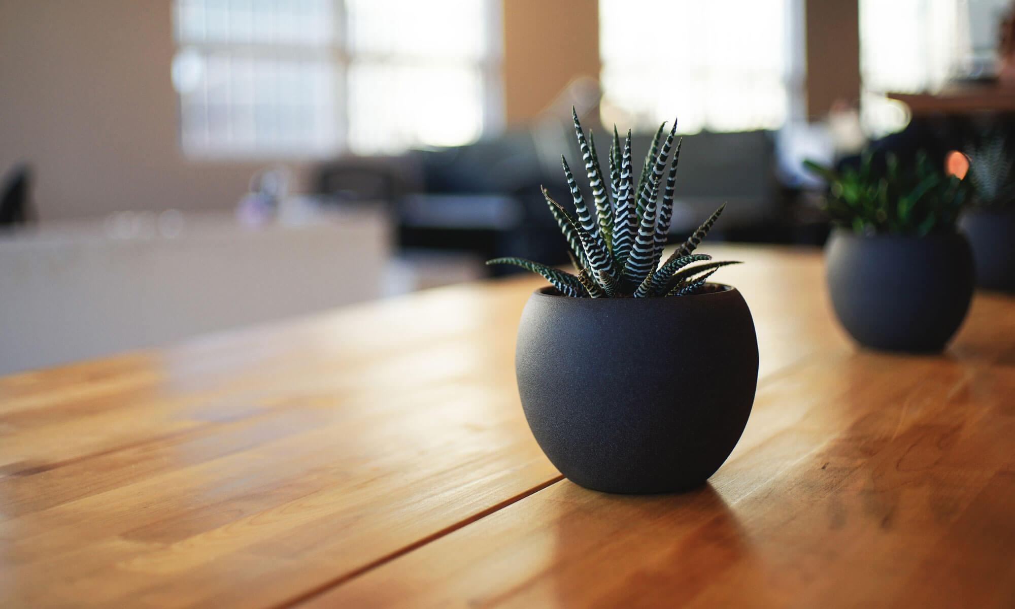
We have a new pergola on our back patio. It looks pretty nice, but as you see, it’s not quite finished…
Sunday, July 26th
For dinner today, we went to the deli at Market of Choice (which Roland used to call the Mother of Markets) and got ourselves a couple of sandwiches and a piece of cake. We then drove down to Finley Wildlife Refuge and had ourselves a picnic. The table we found was just outside the Refuge store. It was late-ish, so the store was closed and there was hardly anyone around.
For entertainment we watched a pair of barn swallows working hard to feed five hungry chicks. The chicks were mostly grown and barely fit in the nest.
We drove up to the Portland airport today to catch a flight to Salt Lake City. Traffic was terrible. Plus, our flight was delayed for an hour. Bah! Once in SLC, though, life was fine. Cousin L picked us up at the airport and took us to Heber City to start our quick visit there.
Saturday, June 13, 2026
L and J have changed houses since we saw them last, and it was nice to see their new place. It’s larger and closer to town than their previous house, which was perched on a mountain slope. The new property is semi-rural and large enough to have a horse. There’s no horse at the moment, but the property did come with a semi-feral cat named Tuhaye, who is gradually warming to the new inhabitants.
After breakfast, we set out to see something of the Heber Valley. First we did a tour of a dairy farm, a relatively small operation that produces milk mostly for the cheese factory just down the road, which is owned by the same family. Ancestors of the current owners came to the Heber Valley from Switzerland in the 1870’s. Many other Swiss also came and for a century or so the main agricultural activity in the area was dairy farming. These days most of the dairies are gone, their land sold to developers.
The farm we visited has been operating at its present site since the 1920’s. Here is the original milk house dating from that era:
We got to look inside the old building and our tour guide told us a little about how dairying changed over the years. One early innovation was to create what were called milking pits, areas that were three or four feet lower than the main level of the stalls, thus allowing the milkers to do their work without having to bend down to reach the udders. Then came milking machines. This building was still in use when they came along. The milking schedule in the old days was simple: once at 3:00 AM and once again at 3:00 PM. Why those times? Milking at 3:00 AM would give the kids time to do their work and still get to school on time. Milking at 3:00 PM meant the kids would again be available once school was over. How did our guide know this? Because that’s how he grew up and eventually became a fourth generation farmer/owner/dairy manager.
These days the children of the family do not have the opportunity to work two milking shifts a day 365 days a year. No one else has that opportunity either. In this dairy, the cows can choose to be milked whenever they want and the actual milking is done by robots. Cows also have access to self-activating back scratching machines like the one in the photo below.
Each cow’s collar shows its number and also carries its electronic ID. When a cow wants to be milked she goes into a milking stall, which opens automatically as she starts to enter and then shuts behind her once she is in. A 3D camera and a robotic milking machine do the rest. The robot records how much milk is collected and sends that data to the central database. The cow is then given a molasses-covered nutrient pellet and the stall opens up in front of her so she can leave. Meanwhile the milking robot scans the milk for impurities–especially blood from mastitis. If there are problems, all of the milk from that session is discarded. And of course that information is also sent to the computer and the farm manager will receive an alert. Cows are allowed to enter a milking stall up to five times per day. On the sixth try, however, the computer will automatically tell the stall not to let them in. Why, you might ask, would a cow want to be milked more than five times in a day? According to our host, it is most likely the molasses.
Here’s the nerve center of the operation:
The windows here overlook the dairy barn. For closer views, the black monitor high up on the wall is capable of showing images from up to thirty-six different cameras. This was not part of the tour per se, but our farmer host did invite us to go up to the administrative level and look around if we wanted. We took this picture from the doorway.
Near the office there is a training/seminar room and also a kind of public viewing area. The viewing area also has windows overlooking the barn level, but, unfortunately, they were some of the dirtiest windows we’ve ever seen. We took a picture anyway:
The black line in the behind the cows is a track that allows the operation of automatic scrapers. These are run several times a day to push manure out of the barn.
This is where the cows spend pretty much all their time. The building is open-walled during the warmer parts of the year. In the winter there is a system that unfolds thick fabric shutters to cover the wall openings. Our host told us that the building was originally designed to allow the cows to have access to the adjoining open pasture anytime they wanted. It was found, though, that the cows rarely went into the pasture, at least partly because the barn was cooler in the summer and warmer in the winter. So after a year or two, pasture access was shut off. Hmm. The maximum capacity of the barn is 250 cows, but their current operation involves just under 150.
After the tour, we had another hayride back to the creamery, where we hoped to sample one of their famous grilled cheese sandwiches. Alas, the sandwich line was long and the space was small. We decided to move along to a resort complex called The Homestead, where we could get a meal and then check out the Homestead Crater.
From the outside, the crater is a cone-shaped formation that looks like a small volcano, maybe fifty or sixty feet high. It has an open crater and if you take the stairs up to the top, you can look down into it. The circular opening is about 20 feet across and has been covered with a sturdy safety net of chain link fence fabric painted black. But if you look down just right, you’ll see reflections off of some kind lake or pool far below. You might also hear splashing sounds as if some kind of largish animals were playing in the lake. As shown by the following series of photos, that’s because there is a swimming pool down there.
A drone’s eye view of the crater…
…a view of the side entrance…
…and finally a view from inside.
The interior pool is 60 feet deep and is fed by an underground hot spring that keeps the water at a steady 95 degrees in all seasons. Pretty neat. Would it have been even nicer if people had refrained from messing with it and just allowed the spring to keep flowing out of the top, depositing its load of dissolved limestone and gradually enlarging the cone, the way it had been doing for a millennium or two? Maybe. Maybe not.
Sunday, June 14, 2026
Today L and J took us to the Heber airport. It’s a small one; the only runway is less than 7000 feet long, too short for commercial airliners. But it was a pretty busy place on this Sunday afternoon. Every ten minutes or so we’d hear the roar and rush of another private jet taking off. Was it always like this? Not really. This was a weekly rush hour caused by lots of folks headed home after spending a couple of days in their mountain retreats. Friday afternoons are busy too because that’s when the weekenders arrive. There’s a lot of hanger space at the Heber airport and J told us that some of the hangers contain small apartments. That way, the pilots who fly the families in on Friday will have a place to stay until they fly them out again on Sunday.
But conspicuous consumption wasn’t what we really came to see. We were there to visit the Commemorative Air Force: Utah Wing Museum. The museum contains several vintage aircraft and a large collection of air war related paraphrenalia: maps, uniforms, survival equipment, cockpit instruments, notebooks, memoirs, mission logs, and other offficial documents. A local Heber Valley man piloted a B-29 in the latter stages of WW2, and a number of his items have been donated. Nearby is a display concerning a different B-29, the one that dropped the first atomic bomb. Included in the exhibit is a facsimile copy of the written orders that gave the U.S. Army Air Force’s 509th Composite Unit the final go ahead to deliver the bomb. Those orders list four possible target cities, leaving the final choice up to the unit commander, who was to base the decision on weather conditions.
Among the equipment on display is a Rolls Royce Griffon V-12 airplane engine of the kind that powered Spitfire and Mustang fighter aircraft in the later stages of WW2. Here’s a nice picture of a refurbished Griffon, which is of course something that everyone should own at least one of. Unfortunately, the photo comes from an old web page and the engine shown is no longer for sale. So even if you have $65,000 rattling around somewhere, you’re still out of luck. But hey, that kind of money would buy you a reasonably nice weekend in Heber Valley where you could see the Griffon that we saw. Donation requested but not required.
Just outside the museum, we had a chance to poke around a real WW2 era aircraft. We can say categorically that it would not be a fun place to work or an easy place to escape from if it was going down, especially if you were assigned to one of the machine gun seats.
This plane appears to be a Lockheed PV-1 Ventura (aka B-34). The lettering indicates that it was used in the Attu campaign in the Aleutians, the island chain that stretches out nearly a thousand miles from the southwest coast of Alaska. In June of 1942 the Japanese occupied two islands near the end of the chain. The United States recaptured them in May of 1943. This particular plane would have been involved in that latter phase.
Monday, June 15, 2026
Time to fly back to Portland. Again, our Alaska Airlines flight was an hour late getting airborne. Aarg! On the other hand, the Monday traffic through Portland was a lot easier to deal with than Friday’s.
Thursday, June 18, 2026
We went down to the Corvallis Arts Center today. Our friend B has some paintings on exhibition there. B gave a short talk and answered questions about his techniques and what he hopes to convey. Very interesting.
Saturday, June 20, 2026
We took the old roadster out today, first packing a little lunch and then heading to Hiatt Farms to buy some baked goods. That accomplished, we continued south down to Bellfountain Park where we could have our picnic. The little beamer is running like a champ, running so well in fact that we may have exceeded the speed limit slightly at some point. As soon as we realized what had happened, we of course throttled back to a sedate 55 or so. This was a good idea because just a few moments later we met a sheriff’s deputy coming from the opposite direction. Bellfountain Park was crowded, but we still found a table with mixed sun and shade–just right.
Monday, June 22, 2026
M took our friend C for her annual birthday ride in the red car, cruising out Decker Road and then up a very interesting part of Highway 34. Beautiful weather for it and no police cars were seen. After the ride, E met them for coffee.
A journey of a thousand miles starts with a single step. But a journey of 1300 miles starts with spending $100 for an oil change and then $85 for a tank of gas. Then you have to pack up your stuff. Then you have to rest.
Tuesday, June 2nd
After a night of rest, M made some sandwiches and then finally got on the road. He was headed up into Washington to pay some more attention to the scablands–the areas affected by the great Missoula floods that occurred during the latter phases of the Ice Age. E, meanwhile, was forced to miss this grand tour so she could attend to a host of engagements and appointments. Luckily for her, M made an extra sandwich and left it for her in the fridge. She was most appreciative of this and even forgave M for locking her out of the house when he left.
M took I-5 to Portland and then I-84 east as far as Biggs. There he exited onto U.S. Hwy 97, turned north and crossed the Columbia River into Washington. As the highway climbed up out of the gorge, he stopped at an old viewpoint, one that looks like it was designed and built in simpler times, perhaps sixty or seventy years ago. Old as it is, this stretch of U.S. 97 was not the first paved road to climb this long slope from the bottom of the gorge up to the rim. The earlier road, older and narrower, was in fact the first macadam highway in all of the Pacific Northwest. It was built between 1909 and 1913 by Samuel Hill, a lawyer, businessman and world traveller. Hill believed strongly in the need for good inter-city highways and paid for the road himself, largely to demonstrate how paved roads could transform vehicular travel and transportation. The demonstration was so successful that by 1913, a new era of publicly funded highways had begun.
Though eventually replaced by U.S. 97, much of Hill’s prototype highway still exists. It is closed to motorized vehicles but open to pedestrians and cyclists. Here’s what the area looks like from the air.
Hill’s road is on the right and the current Highway 97 is on the left. The viewpoint loop where M stopped to take his pictures can be seen beside 97 in the upper left. There was no one there at the viewpoint when this picture was taken, and in fact, as far as we know, no one ever stops there except M.
Although both roads climb the same slope, Hill’s 113-year-old road has more low speed turns and a much gentler overall grade. This should not surprise us: it was engineered for the motor vehicles of his era, which were far slower and less powerful than later ones.
The Columbia Gorge is one of the windiest places in Oregon and now hosts dozens (hundreds?) of wind turbines.
By the time M got up out of the gorge it was…lunchtime. Siri found him a nice park in Goldendale. Thank goodness for parks. Or more precisely, let’s be thankful that some sufficient number of human beings like parks enough to think that we ought to spend public tax money to create and maintain them.
Of course central Washington is not all parks, which is good because that would be boring. Here’s a place just south of the town of Toppenish. It’s also pretty nice…
…but again, we should probably be grateful that not all of Central Washington looks like this.
After lunch M drove up to Ellensburg, where he bought another $85 worth of gas. How far is it from Corvallis to Ellensburg, you might ask. Well…most sources say that the driving distance is 306 miles. In fact all the sources say that, except one. While M was checking those various sources, an AI popped up to offer a more complete answer:
Screenshot
Could that possibly be true? Should we spend some time trying to imagine a universe where it would be true? No, we need to move along. From Ellensburg M turned east and drove to Ephrata, WA where he checked in to a motel.
Ephrata, WA has given its name to a geologic feature called the Ephrata Fan. To explain the fan, we have to start around sixteen million years ago, a time of intense volcanic activity over large areas of present day Washington, Idaho and Oregon. The lava that emerged from the earth at this time was highly liquid. Instead of building up large cone-shaped mountains, it just oozed up from the ground and flowed outward, covering the surrounding area with a new layer of rock from 80 to 300 feet in thickness. One hundred and seventy-five of such vents have been identified in Washington state alone. Over a period of several million years, the cumulative effect of these flows was to cover the whole area with a layer of rock that in some places was many thousands of feet thick. The weight of all this new rock–called basalt–was so great that it caused the granite layers beneath it to actually sink farther down into the earth.
When this great upflow of lava finally ceased–about six million years ago–the result was a vast gently rolling landscape. The bedrock has since been covered with layers of gravel, sand and soil, but the current landscape still follows the contours of the underlying basalt flows. More on that later.
But now we skip ahead to a mere fifteen thousand years ago, a time when the great Ice Ages were gradually coming to an end. That process created a series of massive ice dams in northern Idaho and Montana. When one of these dams failed, huge quantities of water would suddenly flow eastward and down into Washington. Wherever they flowed they would immediately wash away all the loose gravel and soil and then begin to erode the basalt. The result of some of that erosion is what M came to see.
Wednesday, June 3rd
The town of Ephrata is twenty miles from the mouth of what is called the Grand Coulee, which is one of the huge channels that resulted when the late Ice Age floods cut their way through the highlands on their way to finding the sea. As M drove up from Ephrata toward the coulee, he found himself in a wide, flat area, much of which looked like this:
Vast quantities of large rocks were deposited here by the floods. What you see here is just the top of a layer of boulders over a hundred feet thick.
Here’s the biggest visible rock. Named Monster Rock, it is estimated to weigh about 1500 tons.
But why were all these rocks dropped here? And why is the area in which they were dropped shaped like a fan? After flowing many miles through a relatively narrow channel, the Ice Age flood waters came out onto a vast open area. At that point the flood spread out into a fan shape, becoming shallower and losing some momentum. The floodwaters were carrying huge amounts of eroded materials. As the current slowed, the largest rocks fell to the bottom first while smaller sized sediments were carried farther along. This created something like a large river delta–except on land. Geologists call it the Ephrata Fan.
Today, there is soil on top of the rock layer and in a few places farmers have been able to dig up the rocks and push them aside to the edges of the field. This is similar to New England fieldstone walls, except that these rocks are two, three or four feet in diameter and can only be moved with heavy machinery. Or, as M observed in one case, a clever farmer could leave all the rocks in place but irrigate the land with giant sprinklers. What would that do? Make the rocks grow even bigger? Naw. M assumes that the farmer was growing grass between the rocks to create pastureland.
Eventually M passed by the small town of Soapville and started up Hwy 17 into the mouth of the Grand Coulee. Eventually he got up into the main part of the coulee, where he saw the sights and did some hiking. One of his hikes took him up to the coulee rim, where he took the photo below. It shows the view looking back down the coulee in the direction he had just come. In the background you can see the nearly vertical coulee walls where the floods chewed away hundreds of feet of ten-million-year-old basalt. Above the cliffs you can glimpse some of the gently rolling countryside that the old lava flows created and which still exists over much of eastern Washington.
Later in the day M explored both the lower and upper sections of the Grand Coulee, partly by road and partly on foot. What he found there is pretty interesting–if you like that sort of thing–maybe interesting enough to merit a separate posting. We will pass it by for the moment. M finished the day with a quick visit to Grand Coulee Dam and a longish drive to Spokane. Arriving there at rush hour was quite a shock after a day of empty spaces. He made it to his hotel–but just barely.
So, you might be thinking, was anything going on in Washington besides sage brush and old rocks? Well, as it happens, M did manage to drop by a fishing hole on the western edge of the fan. He himself doesn’t fish, but he found others there who do.
Thursday, June 4th
From Spokane M headed south, aiming for a place called Steptoe Butte. Steptoe is a rarity for this area–a landform created by an actual volcanic cone. It is only about four million years old, much younger than the underlying basalt. It rises 1200 feet above its surroundings. M drove to the top. It was an arduous drive but quite worthwhile. The weather was very fine and the summit is the perfect place to see the landscape of rolling hills and wavelike patterns that were shaped by those ten to sixteen million year old lava flows.
The first photo in the series above is the view to the south; the last photo is the view to the northwest. As you see, the northwest area hosts a fairly extensive wind farm. While he was at the top of Steptoe, M chatted with an old farmer who had also come up to enjoy the view. He lived just a few miles south of the butte and was very pleased that the people of his county had put through regulations that effectively prevented the erection of wind turbines in their area. Comparing the two views–south and northwest–you couldn’t blame him. He also asserted that wind turbines were useless anyway since they never produced enough power to justify their initial cost. Darn. How did he figure that out? Wasn’t that supposed to be a secret?
From Steptoe M continued south to Pullman, WA and thence to Lewiston, ID. M had never seen Lewiston before. It turned out to be a fairly ordinary settlement in an extraordinarily beautiful setting. M found his way through Lewiston (and neighboring Clarkston) and got himself onto Hwy 129 going south toward Oregon. Then, in the seemingly innocent small town of Asotin, disaster struck. Foolishly confident that he was still headed south, M actually veered off to the west. After a while the pavement ended and soon he found himself nudging his truck through a herd of cattle who were also traveling down the road in a westerly direction. A little while after that the rolling hills turned in roller coaster hills…
…and M began to think something was wrong.
In the end M left farming country and ended up making a quick tour of Umatilla National Forest. By the time he got back to his proper road at the town of Anatone, he had wasted a couple of hours and a certain amount of expensive gas. Not that the Umatilla National Forest wasn’t nice. It was beautiful. It was also totally deserted, which M likes, and in the area where he stopped to eat his lunch, he got a pretty good view.
Fortunately, M had gotten up early enough and driven through Umatilla National Forest fast enough that he still had time to get to his campground at Wallowa Lake. On the way there he stopped at a wayside on Oregon Hwy 3, which turned out to give a view of what our maps now call Joseph Creek Canyon.
This canyon was one of the places where the Chief Joseph Band of the Nez Perce had their traditional winter home. In the bottom of the canyon wintertime temperatures are considerably warmer than in the surrounding highlands. Here the Nez Perce built semi-permanent structures and cached large quantities of camas bulbs for use in times of famine. During the time of troubles with the whites the band left the area and were never able to return. Chief Joseph himself seems to have been an extraordinary person who was much admired by friend and foe alike. His image still haunts the northwest.
Friday, June 5th
A day of driving, eight and a half hours. Breakfast cooked on the Coleman in the campground, lunch at a rest stop off I-84 in the gorge, dinner at home.
Saturday, June 6th
Today is the 82nd anniversary of D-Day–June 6, 1944. We marked the occasion by going to an actual big screen multiplex and watching Pressure, a movie about D-Day that focuses on the weather. Specifically, how did Eisenhower know if the weather was going to be good enough to allow the invasion to take place on June 6th? The film closely follows actual events. The story is almost certainly overdramatized, but not–thank goodness–oversimplified. Brendon Fraser plays Eisenhower, Kerry Condon plays his aide and long time companion Kay Summersby, and Andrew Scott plays the central role of James Stagg, the British meteorologist who had to make what might be history’s most fateful weather forecast. All three actors do good work here and we liked the film a lot.
And speaking of things WW2ish, here’s an Irving Berlin song from that era. This version was recorded on April 9, 1941, at a time when Britain was already at war but the United States was not.
Monday, June 8th
A day of mundane errands, gardening and grocery shopping. There was only one event of significance, as documented below.
Tuesday, June 9th
Family member A has qualified to join a team of Vancouver sim drivers to participate in an international virtual racing series. Races are streamed live every Tuesday, but are also available for later viewing. To follow Andy’s progress, go to Pit Road Productions on YouTube and look for Shop v Shop Imola Round 2 or Shop v Shop Watkins Glen Round 1.
M spent only one day exploring the Grand Coulee, which wasn’t nearly enough. Most of this limited time was spent on two hikes, both of them in the area of Sun Lakes Dry Falls State Park. He chose these on the basis of information in a wonderful book by Bruce Bjornstad called On the Trail of the Ice Age Floods–The Northern Reaches. Bjornstad’s guide includes a great deal of geological information as well as detailed instructions about how to get to places where you can see real examples. M is very grateful to his neighbor M for telling him about the book. It is out of print, but used copies are available here and there. On this trip M carried a copy from the Corvallis Benton County Library.
Hike #1 – Caribou Trail
Accessible from State Park Road, this trail starts in the bottom of the coulee and climbs up to the east rim, offering a nice long distance view down the Grand Coulee and also providing a good angle to see what is called the Pothole Field on the coulee floor. Not far from the trailhead the route passes just a few feet from the edge of one on these holes.
It’s hard to say how deep this hole is because the bottom is obscured by a heavy growth of small trees and shrubs, probably because it’s a little damper down there than up on the surface. It looks like the hole goes down only about 12 feet.
From a little farther up the trail you can see that there are many such holes in the coulee bottom, some of them more circular than others. Bjornstad says that the deeper ones go down 30 feet or more.
It is thought that the potholes were created by the end of ice age floods, but what was the mechanism? If we can imagine the coulee full to the brim with a rushing river 400 feet deep, we might next try to imagine what things might be like at the bottom of that river as it falls down over a 400 foot cliff, as it does at the spot now known as Dry Falls. There would have been a tremendous amount of erosion going on and also a tremendous amount of turbulence. Geologists now believe that this environment created underwater whirlpools, whose erosive force drilled down into the basalt.
About halfway along its length the Caribou Trail makes a hard right turn and enters a side canyon–a very rare break in the normally vertical coulee walls. At the top, as Bjornstad explains, hikers have to leave the trail and stroll left across a field of rocks and grass to get to the coulee rim. There are a number of great views there, including this one looking back south down the coulee.
To see the scale of things, try to find M’s silver pickup parked at the trailhead. It’s just a speck at the end of a barely visible road just to the left of the center of the photo. Now imagine a giant river running through here from right to left, a river flowing at about sixty miles an hour and so deep that it filled the channel all the way up to the top of the coulee walls.
Another thing you can see in the photo is how erosion has revealed the layer cake nature of the basalt. Each layer was laid down by a separate eruption event, with each of these events occurring hundreds of thousands of years apart–maybe millions. The period of greatest volcanic activity is said to have been from 16 million years ago up until 8 million years ago, so there was plenty of time for long pauses between layers. Also visible in the photo are a few potholes over on the right.
Hike #2 — Umatilla Rock Trail
Accessible from another branch of State Park Road, this trail starts at the base of Umatilla Rock and continues alongside that formation north up the coulee toward Dry Falls. Umatilla Rock is a striking feature–a long narrow strand of basalt that somehow remained after the rock on either side had been eroded away. It is an example of what are called rock blades or goat islands.
This is the south end of the Umatilla Rock formation. Behind what you can see here, the rock extends north for nearly a mile.
The trail goes along the right side of formation and makes for an interesting journey.
This photo shows a part of the Umatilla formation that extends north from the base. It also shows where a person might finally find a rock smooth enough sit down on and have lunch.
And here’s a view in the opposite direction, showing the area of coulee bottom that lies between the Umatilla formation and the opposite wall of the water channel.
More irregular outcroppings along the way.
Eventually the trail crosses to the other side of the coulee where you can get a closer look at the west facing walls. Here’s photo from there. Notice that there are various shapes and patterns in the layers of basalt that the erosion has exposed. We also see a gravel slope at the base of the upper wall. This gravel, which Zentner called talus, comes from natural weathering processes that have occurred in the millennia that have passed since the floods occurred. During flood times, the talus wouldn’t have been there; it would all have been bare rock, scrubbed clean.
Although basalt is hard rock, it is more easily eroded than most other types of rock. This is due to the fact that it is formed by cooling lava. Lava does not cool evenly. Instead the process of cooling causes cracks to form, lots of cracks. Geologists have distinguished three or four different types of cracking, each of which forms a different looking basalt. In the center of the above photo, you can see one of the more spectacular kinds of basalt cracks–long vertical ones. When this kind of basalt is sliced open by erosion, the result is what appears to be a multitude of rock columns. Nick Zentner says that basalt comes pre-cut, like it was specially designed to fall apart into smaller pieces if you put pressure on it. In the case of the Grand Coulee, the floods would have applied plenty of pressure. They would then have whisked the loose pieces away and deposited them thirty miles south somewhere in the Ephrata fan.
The Umatilla Rock Trail also leads to views of Dry Falls, which many think is the most impressive feature of the whole system. The rim of Dry Falls is 400 feet above the coulee floor and three and a half miles wide. Over this rim flowed the great floods. You might think that this would have created quite a waterfall. But if we try to imagine it, we have to remember that the floodwaters flowing toward the falls were themselves hundreds of feet deep. So if we could have seen it all from above, it might have looked more like some large scale splashing and major turbulence rather than an actual waterfall. (Would a good kayaker been able to run it? Hmm. Maybe a really big kayaker.) Click the link to see a very nice photo of what Dry Falls looks like now–in the winter.
For more information, do check out Nick Zentner, who teaches Geology at Central Washington University. Known for his PBS series Nick on the Rocks, he has also made a large number of YouTube videos. One that is especially relevant to the Grand Coulee is Dry Falls and Palouse Falls. The falls may be dry, but Nick is not! And finally, if you don’t know him already, you might want to learn about J Harlen Bretz, the person who first understood what must have happened so long ago to create the Central Washington landscapes we see today.
Today we attended an event sponsored by OSURA, the OSU Retirees Association. The speaker was women’s basketball coach Scott Rueck. Rueck has been coaching at OSU for 14 years and his teams have had a lot of success, three of his teams having made it into the Elite Eight and one into the Final Four. His OSURA talk is an annual event and we’ve attended two or three times over the years. Rueck is a positive and engaging speaker; listening to him always seems like time well spent. Today there were about 50 people in attendance, most of whom have been fans during his whole tenure and who have gotten to know him over the years. This made for a very relaxed event, like a gathering of old friends. He talked about the ups and downs of the season just ended and about how much he enjoys finding ways to help his athletes improve their abilities. The audience was mostly white-haired, but M got to sit next to a good looking redhead.
In other news, M reports that whatever else is going on in Washington D.C., the passport office is still functioning. Renewals can now be done online, so on May 1st M submitted his application. On May 2nd he received confirmation that his application had been received. On May 4th he was advised that his application was being processed and that this would take 4-6 weeks. On May 5th he was told that his new passport had been shipped. Today, May 7th, it appeared in his mailbox.
Friday, May 9th
We ran across a gopher snake up in the OSU forest today. It’s been a decade or two since we last saw one there.
Saturday, May 9th
We went up to Vancouver today for an early Mother’s Day celebration. The Andees took us up to Woodland, Washington to visit the Hulda Klager Lilac Gardens. Hulda Thiel Klager was born in Germany in 1863 and came to the U.S. when she was just two years old. She married Frank Klager in 1879 at the age of sixteen. Around the turn of the century, with her children mostly grown up, she was given a book about the work and methods of Luther Burbank. From then on she devoted much of her time to plants, creating many new plant varieties, especially lilacs. By 1920 she had become widely known as The Lilac Lady. Klager died in 1960 at the age of ninety-six. The story of her life and the rather dramatic history of her garden can be found here.
Before we left the gardens we had a picnic lunch catered by the Andees. No need to go into details, but we will mention that lunch came packed in a deluxe vintage picnic basket and that it included chocolate chip cookies.
Saturday, May 16th
We went along on a birding walk today at Inspiration Garden up in Monmouth. We spent about two hours peering through binoculars and listening to the group leaders giving us pointers about how to identify birds by sight and sound. We heard or saw 32 different species, including a kestrel eating its lunch on a flat topped outdoor light fixture. But that was a little far away. Among the birds that we saw more clearly, the standout was a black headed grosbeak.
This photo was not taken by either of us because we were not carrying cameras with 18-inch long telephoto lens–like some people. But this bird is exactly like the one we saw.
We came for the birds, not the gardens, but we did take time to notice an iris or two. For some reason, they’re easier to photograph than birds.
Monday, May 18th
Today we slaved away in the garden all morning and then in the afternoon drove up to Brooks, Oregon to visit the Adelman Peony Gardens. What a place that is! They must have twenty or thirty acres of peony fields. What do they do with all those flowers?! For a few weeks in May and June, they are open for retail sales of potted peonies. They have several dozen varieties in stock with prices ranging from $20 up to more than $100. They were doing a very brisk business at around 2:00 PM on a Monday.
Have you ever seen a vintage lowrider Chevy pickup full of peonies? We have. Does every peony farm have one of these?
In the background of the truck photo you can see some of the many varieties for sale. Those were beautiful, but the really spectacular blooms were to be found inside the sales room. Here are some examples.
And of course they have a nice website. If you would like to know more about the different sorts of peonies, click here. If you would like to purchase a nice expensive peony, try this one. In total there are over 500 varieties for sale at Adelman’s. All can be ordered online with individual plants being delivered September 15 to October 15. If you don’t need a peony, how about a canvas tote?
We have some peonies in our garden, all given to us by neighbors. We like them because they come up every year and require little care. They are also very pretty, of course. But we have reservations. Aren’t they a little too showy? Rolls Royces are nice cars, but there is a tinge of vulgarity in owning one. Peony cultivation has a very long history, dating back at least to the sixth century. Ancient texts from China mention medicinal uses and also the use of peony flowers as a flavoring agent.
Tuesday, May 19th
Actually we’ve been overwhelmed with flowers lately. Our back garden is being overrun by a plague of volunteer poppies, rapidly spreading calla lilies, and Oregon blue flax popping up everywhere except where we’d like to see it. See below for some glimpses into the chaos.
Bloody Crane’s-Bill, Geranium sanguineum.
Despite the iris, thimbleberry and cascara, who are all trying to shade it out, there is a salal plant back in there somewhere and it seems to be doing okay.
These callas are where they belong, planted there by the previous owners who knows how many years ago.
This used to be lawn. No one ever planted poppies here. Now they’re taking over. Rogue calla lilies are also springing up.
Pale Yellow-eyed Grass, Sisyrinchium striatum. About four feet tall.
Blue-eyed Grass, Sisyrinchium angustifolim. About 5 inches tall.
This area also used to be all grass. But now…clockwise from top: weeds, ranunculus starts, weeds, young service berry, weeds, weeds, bridge, wild flax, weeds, tidy tips, weeds, monkey flower, weeds.
We’re having absolutely beautiful spring weather here in Corvallis, so what do we do? We leave town. Why, because we planned to; this was our five-day window to take a road trip. As it turned out, not only did we leave good weather behind, we drove endless miles only to find bad weather. That’s what planning will do for you.
The trip started off nicely enough. We left at 9:00 in the morning and drove across the mountains to Sisters, home of one of our all time favorite bakeries. It was after 11:00 when we got there, but they still had plenty to offer: a chocolate raised bar for M, a chocolate old fashioned for E, and two marionberry scones for another day.
Thus fortified, we went for a hike on the Whychus Creek trail, located just south of Sisters. It was steep in places and gave us quite a workout, but that was fine–sort of. The area is quite beautiful, in a very different way from the wetter forests on the west side of the Cascades.
The trees around Sisters aren’t as tall…and they grow out of rocks.
After the hike we went on to Bend and stayed the night. Our hotel had an unfamiliar name: Home 2 Suites by Hilton–but we liked it a lot. We were on the fourth floor with a beautiful view…
…of a car wash.
Sunday, April 26th
We had a long drive today, about 350 miles, from Bend down to Winnemucca, Nevada. Traveling south-southeast, we soon left the trees behind and got into sagebrush country. After a while we also left the sun behind and ran into some rain showers. We also encountered an unusual 45-minute delay on Highway 78. We were almost to the top of a low pass when we saw a flagger holding out his stop sign. For the first 15 minutes there was nothing else, just one flagger and our single car. Gradually though, the level of activity increased. As it happened, the delay was to allow passage of two semi trucks towing oversized flat trailers. On each trailer was a giant shiny blue metal box. Each box was roughly 12 feet tall and 20 feet square. In other words, those boxes were big, easily wide enough to take up the whole width of a two-lane highway like Oregon 78. So the procedure was basically to close 15 or 20 miles of road and let the trucks proceed alone to a place where they could pull over enough to allow other traffic to squeeze by, one lane at a time. Then they would close the next stretch of road and repeat. The flagger we first saw was actually part of team of about ten workers who were managing all this, many of them zipping around in unmarked but new looking black pickup trucks that were rushing back and forth on the closed sections. What was the purpose of those blue boxes, you ask? Beats us. It’s not like they were advertising.
Despite this delay, we got to Winnemucca early enough to walk around a bit before dinner. The rain had paused.
At 5:00 we went to our old favorite restaurant to have some dinner, but there we had a shock. Although it was still open, it had gone downhill, way downhill. We did not go in, and instead looked for somewhere else, which turned out to be–quite unexpectedly–a Korean restaurant. Are there lots of ethnic Koreans in Winnemucca? Well, we aren’t sure, but we very strongly doubt it. The owner/manager of the restaurant is a Korean woman who married an American paratrooper while he was stationed in her native country. The restaurant’s name is Koreana, and the food is good.
After dinner we went out to our glampsite in Grass Valley, about 13 miles south of Winnemucca. Yes, friends, we stayed in the “Billy the Kid” glamping tent at Star Gaze ranch so you don’t have to. Our accommodation there was a large tent set on a platform a few feet above the ground. Inside were a queen bed, a wood stove, a solar powered charging station, a propane heater, a couple of board games, three books about old west outlaws, and one BB gun with lots of extra BBs. Toilet facilities were–as one reviewer put it–“interesting but functional.” On the platform outside the tent there was room for a porch with two Adirondack chairs. Also outside, on ground level, there was a gas fired grill, a gas fired pizza oven and a metal bowl fire pit, as well as a rack of hanging targets to test your prowess with the BB gun. There was also a five gallon container of what the hosts called spring water, which was, in fact, delicious.
The bed was comfortable and the bedcovers were thick. The place was cold and rain was pounding down, but we lit a fire in the wood stove and things got toasty fast. (Eventually, when we let the fire burn down, it got colder fast too.) Somewhat to our surprise, we did not perish in the night.
Here’s the scene. In the background is the view to the north.
And here’s the view toward the west. It’s what you see if you sit in the Adirondack chairs. These two photos are were actually taken early in the morning on Tuesday, when the weather had cleared.
Monday, April 27th
We had opted for the extra cost breakfast and it was delivered promptly at 8:00 from the ranch house a few hundred yards away. For each day we ordered one breakfast sandwich (delicious!), one order of Danish pastry (ditto!), and one large thermos of what the hosts called coffee. It was weak, but it was hot and there was lots of it. The sandwich and pastries also arrived nice and warm. That was a very good thing, as the outside temperature was probably still in the 30’s at this point. We were running the propane heater, but it wasn’t doing much.
Our plan for the day was to drive down the freeway to Imlay and then take Pioneer Road north into the mountains. We had hoped to go up through Rosebud Canyon and onward to the ghost town of Sulphur at the northeast end of the Black Rock Desert. But it looked like the weather wasn’t going to cooperate. While it was not raining where we were, the skies were heavily overcast and we could see the dark lines of active showers here and there in all directions. Going deep into the back county on deserted roads in bad weather did not seem wise.
In the end we decided to follow the lower reaches of Pioneer Road and gauge conditions as we went along. Pioneer Road–as the name implies–was a route used by gold seekers and settlers in the mid 1800’s. The main California Trail, which follows the course of the Humboldt River, ran mostly west across Nevada toward Central California. Travelers who wished to go to Northern California had to turn off the main trail near the present town of Imlay. That route to the north is now called Pioneer Road.
The actual place where the two routes split is a few miles north of Imlay. These days there is a natural kind of parklike area there. It’s a nice spot. Only a few people come there these days, but it is easy to imagine it crowded with weary travelers back in the mid 1800’s.
The weather was fairly nice at this point and we had hopes of being able to go a little farther.
But even as we tarried there by the river, the sky was getting a little darker.
We soon left the river and continued north for half an hour on Pioneer Road, reaching the top of a range of hills, where a small sign informed us that we had reached Imlay Summit. It had been raining lightly on the way up and then at the summit the rain had turned to very light snow. It was charming and pretty, but we turned around.
We did a little more low altitude exploring on the way back to our tent. In late afternoon the weather cleared and the temperature dropped. We had a camp dinner of sandwiches and a can of Amy’s soup heated on the wood stove. Again the tent was fairly warm as long as the fire was going. When the fire went out, we found some extra covers and got some sleep. But the night was colder than the previous night and around 4:00AM, we decided to start up the little propane heater.
Tuesday, April 28th
In the morning the weather was still clear and cold. When we got up, the sun had not yet risen over the small mountain range to the east; so our little world was pretty frosty, probably somewhere around 30F. While we waited for breakfast to arrive, we started packing up. When breakfast arrived, we chatted a bit with our host. He mentioned that a new lithium mine will soon be coming online just sixty miles from Winnemucca. The mine and its associated refining facilities will create hundreds of new jobs. For better or worse, that will have a big impact on the town.
(Currently there is only one lithium mine in the United States, a small operation near the town of Silver Peak, Nevada. The new mine near Winnemucca is expected to produce about forty times as much lithium as the Silver Peak mine. General Motors is a major investor in the new project. Interestingly, the U.S. Department of Energy also holds a 5% stake. Several more new lithium mines have been proposed in Nevada and Eastern Oregon and are in various stages of approval.)
By 9:00 we were on the road. The day’s plan was for us to begin the long drive home to Corvallis, returning not by the way we had come but by a route a little more off the beaten path. First we got on I-80 and drove thirty miles west to the town of Lovelock, where we filled up with gas. The station had a giant piece of a very old tree out in front facing the road.
We don’t know where this big section of log came from. It doesn’t seem like there would be any trees at all within a hundred miles of Lovelock.
Having gassed up, we got back on I-80 for another fifteen miles before exiting at a place called Toulon, the site of a now abandoned mineral refinery. There we turned north and took Ragged Top Road up into the Trinity Mountains. Our reasons for making this turn were simple, as can be shown by the map below.
Suppose you had been freezing to death in a tent just northeast of Imlay in the upper right corner of this map and you wanted to get to Gerlach in the upper left corner, because from Gerlach, you could eventually get to Lakeview, where you had reserved a nice warm motel room. Would you just take the freeway down to Fernley (bottom, left) and then drive up to Gerlach from there? Of course you wouldn’t. That would be crazy. Would you go down to Lovelock and turn right onto a dead end road leading to a mining area? No, that would be foolish. Wouldn’t it be best to go down to the center of the map where those three little lakes are and then turn off onto a scenic route that goes straight up to Gerlach? Of course it would. But wait, you say. Are you sure there’s a road there? Why isn’t it on the map? Tsk, tsk. Of course there’s a road, a lovely road. Just go to Toulon (the one in Nevada, not the one in France) and you’ll find it.
Just a couple of miles up Ragged Top Road, you can see how the road got its name.
The route took us across three small mountain ranges. Here we are at the top of the first one, looking down toward the road leading to the second one. This day the weather was nice.
Here’s what that straight stretch of road looked like after when we got down onto it. .
Just past the summit of the Trinities, we started to see antelope. We ended up seeing three separate groups of four, plus one singleton. A few miles away, we also saw a big coyote, who was moving too fast for a photo.
Whenever we came across one of the small herds, they would startle and bound away from us, their white rears bobbing up and down as they ran. But then at a certain distance away they would all stop at once and turn to gaze back at us.
After a couple of hours of lovely views and slow going, we came to the end of Ragged Top Road and got back onto pavement just twenty miles south of Gerlach. In that town–known famously as the Gateway to Burning Man, or, as the locals like to call it, The Center of the Known Universe–we stopped and ate our lunch at a tiny park.
From there we drove north to Cedarville, CA and thence up to Lakeview, OR, arriving there just before 5:00. We were glad to have a heated room and a pretty good restaurant just half a block away. It had been a long day.
Wednesday, April 29th
We drove home via Sprague River, Chiloquin, and Highway 58, which took us to Eugene. And, since we were there, E thought we might as well drop by the Oakway Mall where she might find some extra sunglasses and a new pair of summer pants.
Saturday, May 2nd
Back in Corvallis flowers are popping out everywhere. E went walking at Oak Creek with her friend B. She says she’d never seen so many delphiniums together in one place.
Monday, May 4th
Today E went out for a walk again, this time at Bald Hill with Graham and Graham’s owner. What did she find? More delphiniums!
Tuesday, May 5th
A while back we noticed that a pair of scrub jays had made a nest in our back garden. Now we see that the garden has a new resident.
Scrub jay parents care for their fledglings for about a month after they leave the nest. This one doesn’t seem to have been out very long.
We went up to Portland today to attend a performance of the Oregon Symphony. Before the performance we had dinner at the Heathman and then went early to the hall to hear an introductory talk by conductor Jun Märkl. He turned out to be a gentleman of the old school, a charming and informative speaker. After that we heard three pieces of French music. First came Omphale’s Spinning Wheel by Saint-Saëns followed by Ravel’s Piano Concerto in G Major, and then, after the intermission, a performance of Suites I and II of Daphnis et Chloé. The highlight for us was the concerto, which featured guest artist Ingrid Fliter. She gave a wonderful performance and even if she hadn’t, her sparkly outfit alone would have made our visit worthwhile.
To avoid having to drive home in the late evening, we had arranged to stay the night across the river in Vancouver, Washington at the home of Jake and Maggie. We had checked in with J and M earlier in the afternoon. When we arrived, they were very, very excited to see us. In fact, we hadn’t seen that level of energy and enthusiasm in quite a while. Was it due to the fact that E and M are such extraordinarily interesting guests? Or did it have more to do with our hosts’ age, their species, and the possibility that we might be going to feed them?
That’s Maggie on the left and her brother Jake on the right.
When we returned to J and M’s place after the concert, the two were just as energetic as ever. The same level of activity continued well into the night. Finally, at around 3:00 AM, E gave them some more food, after which they immediately settled in to sleep with us.
Sunday, April 12th
After escaping the clutches of Maggie and Jake, we did a mall visit and then had lunch at a Thai restaurant before heading back to Corvallis. The food was delicious, but there was a fellow near us who was coughing all the time. Oh-oh.
Thursday, April 16th
From the 16th to the 19th we were both sick with colds. Hmm. How could that have happened? What could we do? Thank goodness we had two good remedies on hand.
500 piece puzzle from the Puzzle Exchange at the Corvallis Library
Despite not feeling well, E went for a walk in the OSU forest where she found quite a few calypso orchids. We see these little flowers most years, but never very many. They tend to be solitary plants, at least around here. Seeing a group of three was extraordinary.
Monday, April 20th
While doing research for his unlikely to be completed autobiography, M came across this rather lovely photo taken from the International Space Station. Funny how national borders don’t show up at all from space. Can you guess what part of the earth this is? (The white stuff is cloud, not snow. And no, it’s not the strait of Hormuz, though it’s not far from there.)
The large body of water is the eastern end of the Mediterranean. The wide fingers of water in the lower left are two branches of the Red Sea–the Gulf of Suez and the Gulf of Aqaba. The peninsula between those two is the Sinai. The narrowest strip of blue on the left is the Nile River. (Check out that delta!) The island is Cyprus, where we lived from 2001 to 2003; the land mass above it is Turkey, where we lived for a year in 2007-08. The hazy land mass beyond Turkey is Europe–Greece, Bulgaria, Ukraine and beyond. As for the land that fills up the lower right of the photo, it is home to all of Israel, Jordan, and Lebanon, and also includes parts of Syria in the north and Saudi Arabia in the south.
Wednesday, April 22nd
We’ve watched two good movies lately, both named for cities and both related to Ireland. Brooklyn (2015) is based on a novel by Colm Tóibín about a young Irish woman who migrates to Brooklyn in the 1950’s. Belfast (2021) is a film by Kenneth Branagh based partly on his own childhood experiences in Belfast during a time of sectarian violence in the late 1960’s. We liked both of them very much.
Thursday, April 23rd
Today we went on a bug tour at the Oregon State Arthropod Collection. This took us to Cordley Hall on the OSU campus, a big 1950s building that has recently had a $147M restoration. Outside it still looks the same, but inside…it’s pretty different.
The Arthropod Collection is on the second floor. Curator/Manager Chris Marshall led the tour of the collection, assisted by senior Associate Curator Paul Hammond. Besides showing us through the refurbished facility and showing off some of the more spectacular specimens, Chris also shared details of how the collection is managed and what kinds of research go on there. It was a pleasure and an inspiration to hear him, as it so often is when real experts describe the issues that they are passionate about. These days the collection focuses on helping with research on local and regional insect populations rather than on the collection of beautiful and/or unusual specimens from exotic locations. But that doesn’t mean they don’t have such things on hand, as Chris made sure to show us.
Here’s a drawer of large blue butterflies from the genus Morpho. Four of them have been mounted upside down to show their very different undersides.
These butterflies are all the same species and are all mounted right side up. Why are they so different? Males are on the left; females are on the right.
Our tour leader is a self-described beetle guy, so we’ll throw in a couple of those.
Here’s the main repository. The big white cabinets move on rails set in the floor, so that they can be “compacted” to save space. When the building was renovated, the construction funds could only be used on the structure itself; the cost of any improvements to the contents of the building were up to the individual departments. This was unfortunate because the Arthropod Collection was badly in need of new specimen cabinets. The collections managers were able to find a small loophole. They argued successfully that because the rails of the new compactor system were permanently set into the floor, they were actually part of the building. With the rails paid for, they were able to get a grant to buy the cabinets that roll on them.
We also learned that the greatest danger to any collection of insect specimens is–ironically–other insects, specifically those insect species that survive in the wild by eating insects, including dead ones. In nature, that’s a good thing; in an insect collection, not so much. For large collections, one of the prime methods of stamping out infestations of living insects is to put the collection trays into a -25 degree freezer for 4 days. This kills the harmful insects without using poisons.
E returned from a trip to New York State where she attended a memorial service for her sister-in-law Joanne, who passed away recently. (Obituary here.)
E is grateful for Joanne’s presence in her life. It was E who first introduced Joanne to her future husband. She’s happy that her long-ago attempt at matchmaking led to 58 years of loving marriage.
Saturday, March 28th
We went downtown to Futura for coffee this afternoon and ran across this sign on the corner:
Sunday, March 29th
While we were hiking down at Finley Refuge today, we saw a bear! Black bear sightings are pretty common in Oregon and we’ve even met a few landowners who routinely see them on their trail cams. But neither of us had ever seen one around here, so we were excited. It happened when we were walking west on the Mill Hill trail at a spot where the path traverses a forested hillside. At the base of the hill there is a wetland that consists of densely packed willows and a largish pond. First we heard something moving down below us. When we looked down, we saw the bear sloshing along in the shallows on the far side of the pond. Our first impression was wow, that black bear is really black. A moment or two later the bear stepped up onto solid land and disappeared into the forest.
Another nice part of the hike was seeing all the wildflowers. They’re going crazy about now. Here are just a few.
trilliumfawn lilywild irisno flowers here yet, but a very impressive mass of wild bleeding heartand there were tons and tons of new poison oak leaves–so shiny and pretty
Monday, March 30th
A busy day today: grocery shopping, gardening…and laundry.
Tuesday, March 31st
We’ve been having nice weather for the last two weeks: some clouds, some sun, highs in the 50’s and lows in the upper 30’s, little or no rain. It’s been great for hiking and working in the garden. But they say that rain is on the way.
Wednesday, April 1st
Bad news today–we were told that the Konditorei, our favorite cake shop, is going out of business. What a disaster! The only bright spot is today’s date.
As predicted, the rain has come, falling steadily all day long.
Like the flowering currant above, many native shrubs are in full bloom these days. Our serviceberry, elderberry, and Oregon grape are also going strong. The last is showy enough to pop out even on a wet day.
And do we have any non-natives? Well, sure: tulips, for example. As far as we could learn, they originated in Central Asia, maybe in Kazakstan. The earliest record of tulip cultivation goes back to Persia (Iran) sometime around the year 1,000.
Irises also came from somewhere else, brought to America by the first European settlers. These are a dwarves.
Easter Sunday, April 5th
Really nice weather–sunny and 70. The Andees came down for Easter dinner. They brought us a lovely bouquet…
…and we gave them eggs. (But they had to go find them in the back yard.)
We spent a great evening with B and B who gave us a wonderful salt cod meal. After that we indulged in some pre-birthday birthday cake.
Birthday season begins!
Sunday, February 22nd
It was another rainy day here, but we went up to Dallas, Oregon anyway. We wanted to see the Delbert Hunter Arboretum and Botanical Garden. It’s a very comfortable little place, occupying about seven acres along the north bank of Rickreall Creek, just across the creek from the Dallas City Park. It was beautiful there, despite (or perhaps partly because of) the rain.
Wednesday, February 25th
Birthday doings continued today when our friend M came by and dropped off a birthday bouquet and this elegant little gift:
We leave it to the reader to imagine what was inside. (Hint: there were nine or ten bite sized pieces.)
Friday, February 27th
The day arrives! In the morning M disappeared, running off to Salem for some reason. Fortunately, he came back before too long. Later on, H and T dropped by with a surprise gift: fresh bread from the Pacific Sourdough bakery, one of E’s favorite things.
Dinner was at Sybaris. M ordered monkfish and shared a chunk of it with E. Neither of us could remember ever tasting monkfish before. Hmm. Based on this experience, we may never taste it again. Not that it was bad; it was just kind of blah. Apparently, though, lots of people think it’s delicious. Everyone agrees that monkfish are ugly. To see why, click here. And by the way, that’s an average sized one; they can get much bigger.
Birthday meals, of course, are not really about entrées. For dessert, we headed back home and opened up the cake that M had fetched from Salem earlier in the day. As requested, it was a Barney’s Blackout from The Konditorei. E found it to be very satisfactory.
Saturday, February 28th
The Andees came down today to get in on the festivities. First they joined E and her friend H for a special tour of the “back room” of the Philomath Museum, the place where they put everything that they want to keep but don’t have room for in the main exhibit area. The storage space isn’t an actual back room but rather an entire new building that has been built in back of the very old building the holds the main museum. That building dates from the period 1866 to 1929 when it was part of the campus of Philomath College.
For lunch, the group went downtown to that nice little restaurant with a funny name. What was it? Ants on a Log? Slugs on a Raft? Something like that. Anyway, their meal gave them the strength to go for a vigorous hike in the forest. Following that, it was back to Oak Avenue where we once again got into that tall, dark cake. Yum. It was altogether a lovely day.
During the forest hike E saw her first fawn lily of the year. (Erythronium oregonum) The bud is barely visible, but the leaves are easy to recognize.
Sunday, March 1st
Today we packed up the truck and drove to Mt Hood in search of snow. There hasn’t been a lot of snowfall out west this year, maybe because other parts of the country got more than their share. Still, we thought we might be able to find someplace with enough snow to hold up a snowshoe. It took about three hours to get up into the Mt Hood recreation area and sure enough we did find some snow. It was a little old and tired looking, but it was there. We drove past Timberline and Mt Hood Meadows and took Highway 35 onto the northeast side of the mountain. We were looking for the Cooper Spur Mountain Resort. When we arrived and checked in, the resort upgraded us from a small bedroom unit to large condo unit. Why? We’re not sure. Possibly because they’d been getting lonely and were glad to see us. The resort is a small place with eight or so hotel style rooms, four condo units and five cabins. All the buildings were log built. Beautiful. The place was pretty empty on a Sunday night at the tail end of the season. Here’s a picture of what it looks like when they have actual, real snow. It wasn’t quite like that for us.
The condo had some nice decor.
The loft had four single beds and an escape hatch…
…that led to this emergency ladder.
Monday, March 2nd
Our major effort of the day was to go snowshoeing on Bear Loop, a two and a half mile trail that is directly accessible from the property. The snow wasn’t very deep. It was easier to get through on snowshoes than without–but just barely. We were the only guests at the resort, so we met no humans on the trail. But that’s not to say that there was no traffic at all…
Toward the end we got a little lost and accidentally wandered off the trail and made a stream crossing that it turned out we shouldn’t have had to make. When we figured that out, we had to turn around and make the same crossing in reverse. M is not too fond of late winter stream crossings, but E finds them delightful. Come to think of it…did E deliberately take us away from the trail just so she could cross that stream? Hmm.
E the Streamcrosser at one end of Bear Loop
Later in the day, we drove down to Parkdale, the nearest town. We’d been in Parkdale before, but on that occasion we had come up from the other direction and we’d travelled by train, Parkdale being the upper terminus of the Mount Hood Railroad.
There are dozens of big apple orchards around Parkdale. There aren’t too many people there, but they all have nice views of the mountain.
Tuesday, March 3rd
We checked out this morning and headed back toward home on Highway 35. But as we went, we looked for somewhere to do a little more snowshoeing. We decided to stop at Pocket Creek Snow Park. Well, the snow wasn’t very good there either–hard packed and often icy. But it was still a beautiful scene, especially when we got off the main trail and onto a long disused logging road. Here we crossed another stream, quite a pretty one.
Wednesday, March 4th
The news of the world is bad and it’s tax time too. Considering those two things together, a person could get pretty depressed. M has a William Elliott Whitmore song stuck in his head. Hear it on YouTube or read lyrics here. Seems like a song for our time.
Crocuses, meanwhile, have their own lives to live.
E went to the dentist today. She reports that her cleaning went well but that the cupcake situation was a fiasco. The cupcakes, it seems, are always delivered early in the week. By Thursday, none remain. How did she end up with a Thursday appointment? Clearly, the system failed. Attempting to rally from this setback, E remembered that she had crafted a backup plan for emergencies: there was a Starbucks quite nearby. She was confident that she could find a substitute treat there. But, then, just a moment later, came another thought. That Starbucks had permanently closed, replaced by the new Starbucks in the former Taco Time on the other side of town. Why does going to the dentist have to be so difficult? Finally, she entered a giant supermarket where she was able to purchase a maple donut…with a really thick layer of frosting. A close call, but all was well.
Friday, February 13th
Spring in the Willamette Valley is a long, slow process, which can be frustrating, especially in May and June when most of the country is seeing sunshine and we’re getting the same dull gray clouds we’ve had since November. But it also means that spring starts early here. In fact, it starts about now. Despite the rather nasty weather–cold and rainy–the usual early arrivals are popping out.
Galanthus, Snow drops
We’re not saying that E put this peanut shell here all by herself, but if you could trace back up the supply chain, we’re betting she’d be in there somewhere. The green thing is–we hope–a tulip.
M wants this to be new and strange, but E says it’s just primose.
Oemleria cerasiformis, osoberry, a.k.a. Indian plum
In our last Meandering post, we mentioned driving through the New Mexico part of the Permian Basin, America’s largest oil field. By chance we have recently learned more about the Permian. Apparently it’s full of zombies. Not zombie people, zombie wells. Oil extraction in the Permian began more than a hundred years ago. Over that time thousands of individual wells have reached the stage where they no longer produce enough oil to be profitable. When that happens, the wells are supposed to be capped and sealed. “How’s that working out?” you might ask. Well, gee, wouldn’t ya know, it’s kind of a mess. Here’s a nice video about some people who are trying to clean it up.
Saturday, Valentine’s Day
M had a great idea for how to celebrate the holiday this year. Instead of getting just one more heart-shaped box of Burst’s chocolates, how about a drive over to the coast where we could pick up a pound or two of salt water taffy? E said that if M really wanted to go over to the coast and buy taffy in place of chocolate, that was fine; as long as he never came back. To see what transpired, watch to the end of the video.
Sunday, February 15th
Both E and M have just reread The Little Prince by Antoine de Saint-Exupéry and found it delightful. Why do we bother with such silliness now, when the world is in such a state? It’s an old book but a good one. The author died in 1944 fighting fascism in World War 2.
Besides reading, we have got ourselves involved with another endless soap opera, this time an Australian one called A Place To Call Home. It is set in a small town in New South Wales during the early 1950’s. Both E and M were alive during the early 1950’s, but we were a little young to be paying much attention to Australia. So this show is a real eye opener for us. Here’s what we’ve learned so far. First, a significant percentage of Australians in that era were unaware of who their real parents were. Relatedly, two thirds of Australian pregnancies in the 50’s were highly inconvenient, potentially even disastrous. The affected women always thought about getting an abortion, but they never actually did so, except in that one case where the poor girl died, but she wasn’t really part of the plot anyway. Third, the above statistics apply only to Australians of Anglo origin. Italian immigrant families did not have these particular challenges, though they did have a few that were uniquely their own. Other issues of the day included how young farm wives really had to struggle to find time to get their novels written and the question of what to do with a small child who kills an abusive adult with a cricket bat. So, you know, it was quite a place.
The clothes are beautiful and very 50ish. Plus, there are many nice period cars, including a 1951 Jaguar Mk. V Saloon and an Australian-built, right hand drive 1948 Buick Super convertible. There is even a period passenger train with a steam powered locomotive.
Monday, February 16th
This year’s Great Backyard Bird Count started Friday and ended today. E made her counts on Friday and Saturday. Her sightings included a pair of Northern Flickers, one of whom was kind enough to allow us to take this video.
Tuesday, February 17th
Today is Tibetan Buddhist New Year. So Losar Tashi Delek to all. We celebrated by having dinner here with J, B and C. In honor of the beginning of the year of the horse, we sacrificed a pig, the peppermint kind.
E has started reading another book by St Exupéry called Wind, Sand and Stars.
Wednesday, February 18th
We went up to Salem today with our friend J, who is shopping for a new car. Her current car, a blue Prius, still runs fairly well, but of course it lacks a number of modern safety features. Also, we see that its floormats have become quite dirty and that there is a fair amount of beach sand in its glove box, so no wonder she wants to replace it. (She will surely miss the car, though, and probably the sand as well.)
Thursday, February 19th
M and J returned to Salem today and this was the result:
After twenty years of driving a blue car, it seems that J was ready for a change.


